The
wildfire threatening Yosemite National Park is spreading further into
the US tourist landmark, officials said as they battled to stop it
clouding a holiday weekend.
Efforts to contain the so-called Rim
Fire, which has grown to become California's sixth biggest wildfire
ever, were also being boosted by the deployment of a military drone
approved by the Pentagon.
The fire, which now covers more than
192,000 acres, or 300 square miles, and is 30 percent contained, has
also threatened San Francisco's water supply, due to ash falling on a
key reservoir.
The blaze, about a quarter of which is now inside
the park's boundaries, "is expected to continue its eastward spread
farther into the west side of Yosemite National Park," said the latest
firefighters' online update.
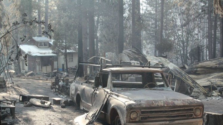
The fire, which started west of the
park on August 17, is threatening some 4,500 structures and on Wednesday
forced the closure of a second main road into the major US tourist
attraction ahead of the Labor Day weekend.
View gallery."
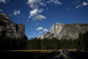
A view of Half Dome and the Yosemite Valley on August 28, 2013 in Yosemite National Park, California …
A
surge of visitors is typically expected over this weekend's Labor Day
holiday at Yosemite, which draws millions of tourists every year, most
in July and August. Labor Day traditionally marks the end of the summer
season.
Read More Here
*********************************************************
Raging California wildfire threatens more of Yosemite
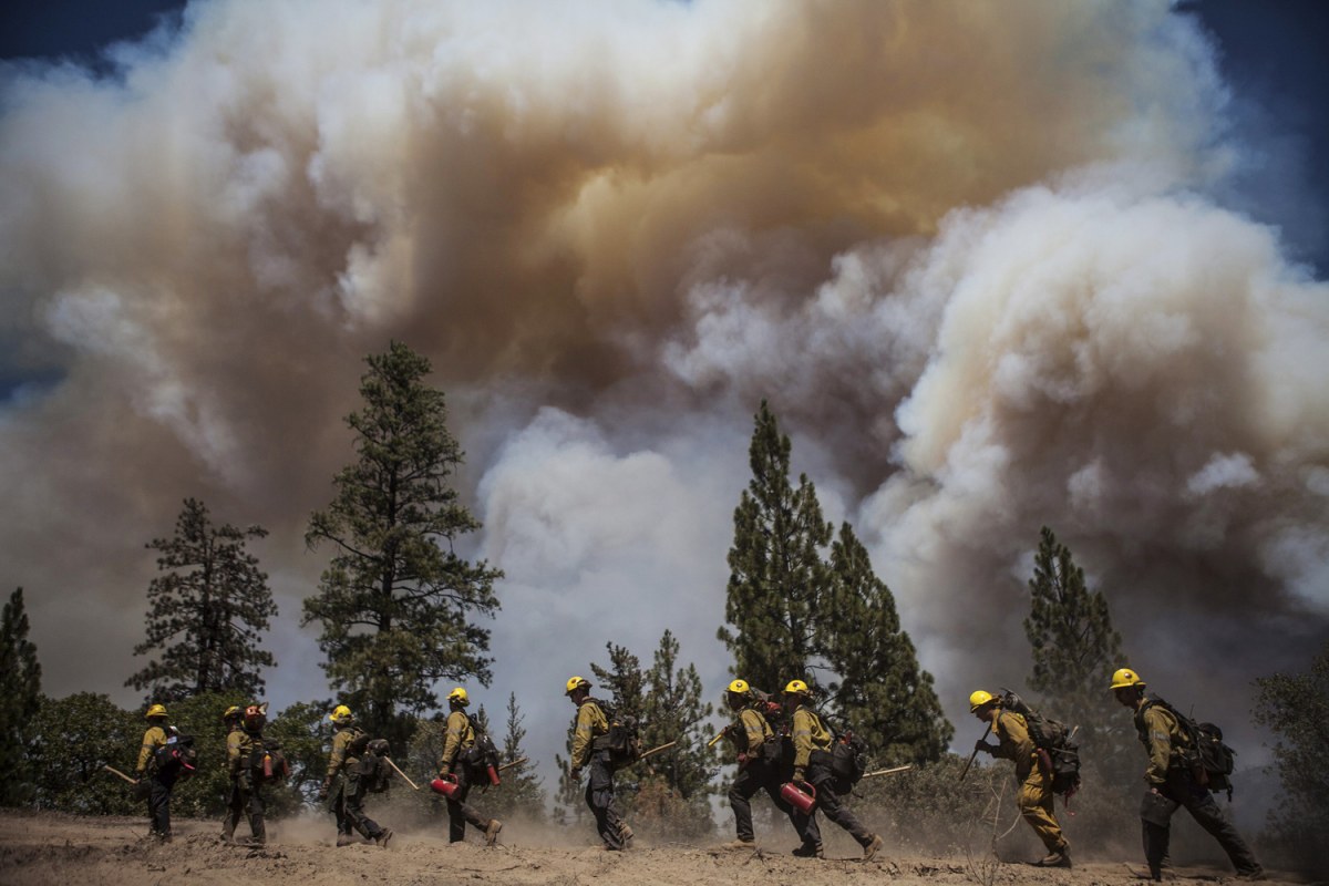
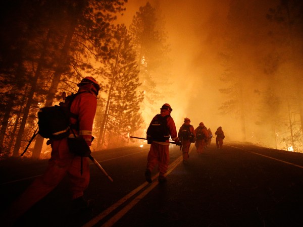
Los Angeles County firefighters hike in on a fire line on the Rim Fire near Groveland, Calif., Aug. 22.
The
wildfire near Yosemite National Park is 20 percent contained, while
more than 4,000 firefighters work towards quelling the huge blaze
altogether. NBC's Tom Costello reports.
By Tom Costello and Tracy Jarrett, NBC News
A
California wildfire that has scorched an area nearly as large as New
York City near Yosemite National Park was 20 percent contained Tuesday,
officials said. But the raging blaze was expected to move farther into
the park and threaten a reservoir that provides most of San Francisco's
water.
The so-called Rim Fire, has charred 179,480 acres, or about
280 square miles, making it California's seventh largest fire in state
history, according to the state's Department of Forestry and Fire
Protection. It threatens 4,500 structures as well as the power and water
utilities for San Francisco, roughly 200 miles to the west.
The
flames also loomed over towering sequoias that are among the largest and
oldest living things on the planet. The iconic trees can withstand
fire, but brutal conditions — including harsh winds and thick brush —
have prompted park employees to take extra precautions in the Tuolumne
and Merced groves, according to the Associated Press.
"All of the
plants and trees in Yosemite are important, but the giant sequoias are
incredibly important both for what they are and as symbols of the
National Park System," park spokesman Scott Gediman told the AP.
*****************************************************
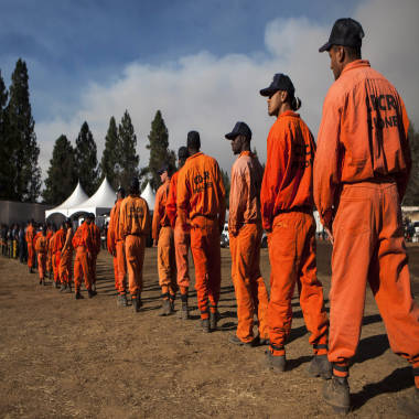
Firefighting felons: Hundreds of inmates battling the Yosemite blaze
Jae C. Hong / AP
Inmate
firefighters, who are paid $1 an hour as part of California's
conservation prison-camp program, work the Rim Fire threatening
Yosemite.
By Tracy Connor, Staff Writer, NBC News
They swing the same Pulaskis, buzz the same chainsaws and face the same dangers.
But
673 of the wildland firefighters battling the ferocious blaze around
Yosemite National Park have something that other hotshot crew members do
not: a prison identification number.
They're part of California's
conservation camp program, which takes convicts out of jail cells and
puts them on the front lines of wildfires, where they earn $1 an hour
cutting containment lines that keep flames from spreading.
"They are in the thick of it," said Capt. Jorge Santana of the California Department of Corrections and Rehabilitation.
The
agency has sent 621 men and 52 women to tackle the so-called Rim Fire,
which has engulfed nearly 300 square miles of land in 12 days. More have
been deployed to 20 other fires across the state.
Max Whittaker/Reuters
Inmate firefighters line up for dinner at the Rim Fire camp near Buck Meadows, Calif.
"They work 24-hour shifts," Santana said. "They sleep in tents at base camp. They work side-by-side with other firefighters.
"They risk their lives."
Other
states have inmate firefighters, but California's program — with 42
minimum-security camps and more than 4,100 volunteers — is the biggest
and oldest, dating to 1946.
Aaron Olguin, 30, said he heard about
it soon after he was sentenced to four years and four months for a
drunken-driving crash in which people were injured.
Like other
applicants, he underwent two weeks of punishing fitness training:
grueling hikes, 9-minute mile-long runs and a regime of military-style
calisthenics. Then came two weeks of job training by the California
Department of Forestry and Fire Protection.
"We hiked straight up mountains with 45 pounds on our back, carrying tools and water and other necessities," he said.
Olguin
got some time shaved off his sentence and spent almost three years in
the program before being released last November. He estimates he worked
up to 20 fires and recalled some "close calls" with falling rocks and
trees at night.
Read More Here
***********************************************************
Military drone drafted to tackle massive Yosemite wildfire; smoke cancels football games
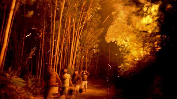
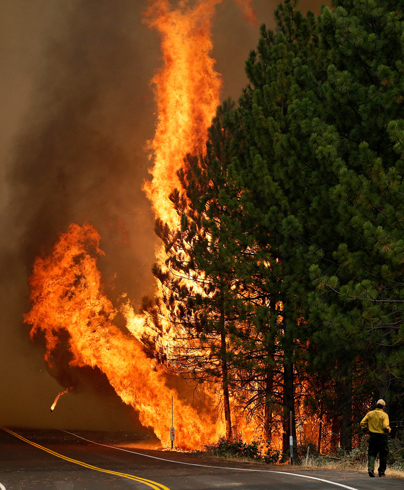
The
Rim Fire burns along Highway 120 near Yosemite National Park, Calif.,
on Aug. 25. With winds gusting and flames jumping from treetop to
treetop, hundreds of firefighters have been deployed to protect
communities in the path of the Rim Fire raging north of Yosemite
National Park.
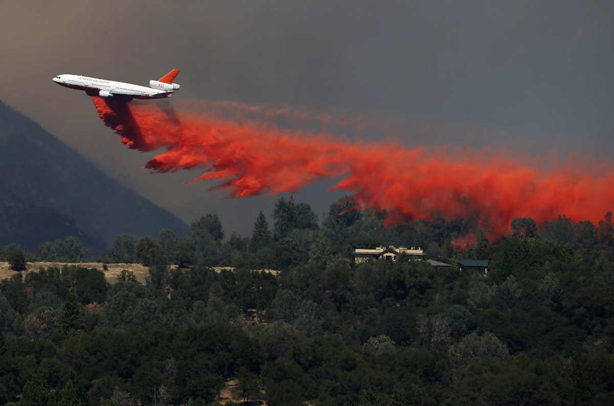
A DC-10 air tanker drops fire retardant on a ridge ahead of the advancing Rim Fire on Aug. 22, in Groveland, Calif.
The
fight against the Western wildfires just got upgraded. Unmanned
military drones are being used in the battle against California's
massive wildfire. NBC's Lester Holt reports.
By Henry Austin, NBC News contributor
An
unmanned military Predator drone, similar to those that have seen
action in Afghanistan, has been called in to battle against a raging
California wildfire that has scorched an area almost as large as New
York City.
The enormous Rim Fire, which has charred 200,000 acres
in 13 days, has unleashed a smoky haze that has worsened air quality
more than 100 miles away in Nevada. High school athletics officials
canceled all football games Friday and Saturday across eight counties in
both states as the air quality index hovered around the "unhealthy"
level.
The drone, an MQ-1 aircraft remotely piloted by the 163rd
Wing of the California National Guard, is helping to provide
round-the-clock information to firefighters.
The
wildfire burning near Yosemite National Park was more than 30 percent
contained as more than 4,000 firefighters continued to make progress.
NBC's Miguel Almaguer reports.
"The drone is providing data
directly back to the incident commander, allowing him to make quick
decisions about which resources to deploy and where," California fire
spokesman Daniel Berlant said.
Previously, crews tackling the blaze relied on helicopters that needed to refuel every two hours, for their air information.
But
the drone, which is the size of a small Cessna plane, will remain over
the burn zone for up to 22 hours at a time, its fitted cameras providing
real-time video on the fire's movement.
Pilots will operate the craft remotely from March Air Reserve Base in Riverside. It will be escorted by a manned aircraft.
Officials
were eager to point out that the images are being used only to aid in
the effort to contain the fire, which has become California's
sixth-largest on record.
Read More and Watch Video Here
***********************************************************