
Published on Nov 8, 2013
One
of the most powerful-ever tropical cyclones based on wind speed has hit
the Filipino island of Samar, forcing millions to flee the area. The
disaster has also sustained wind gusts of 170 mph (275 kph), according
to the Joint Typhoon Warning Center, besting the previous record held by
Hurricane Camile, which struck the US in Mississippi with 190 mph (305
kph) winds in 1969. READ MORE: http://on.rt.com/8r7kg9RT LIVE http://rt.com/on-air
..........
By Matt Daniel and Deborah Byrd in
Nov 08, 2013
Super Typhoon Haiyan pounds the Philippines
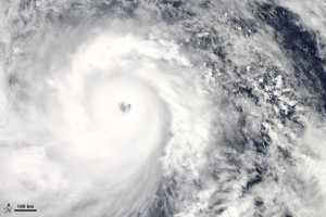
Super Typhoon Haiyan on November 7. Image via NASA. Super Typhoon Haiyan, called Yolanda in the Philippines, made landfall as one of the strongest storms ever recorded on Earth.
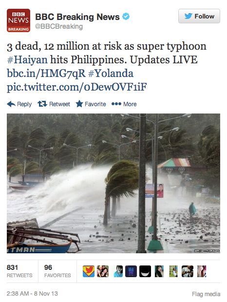
Three people were reported dead, more than 100,000 took refuge in evacuation centers and hundreds of flights were canceled.
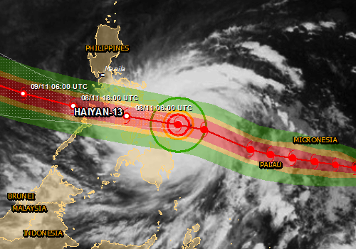
Yolanda or Haiyan is one of the worst storms on Earth, ever. The Global Disaster Alert and Coordination System (GDACS) had said on November 6:
Tropical Cyclone HAIYAN-13 can have a high humanitarian impact based on the maximum sustained wind speed and the affected population and their vulnerability.Luckily, the storm was not headed for Manila, the capital and second-most-populous city of the Philippines. In Manila, which is prone to floods, the lowest alert in a four-level typhoon warning system was issued. The storm passed near Tacloban, a city of close to a quarter million people, and Cebu, a city of close to one million people.
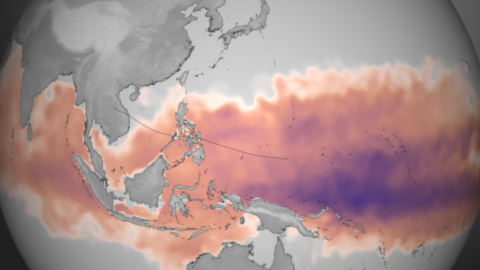
The U.S. Navy’s Joint Typhoon Warning Center had earlier said it expected the storm to weaken as it crossed the ocean to the Philippines. Instead, Haiyan intensified and accelerated as it moved closer to the country. Why? According to NOAA’s Visualization Laboratory, deep warm water in the Pacific fueled Haiyan’s intensification. NOAA said that “ideal” environmental conditions for intensification – namely low wind shear and warm ocean temperatures – exist in the Pacific now. See the orange-ish image below.

NASA’s
Aqua satellite acquired this natural color image of Super Typhoon
Haiyan as it approached the east coast of the Philippines at 1:25 p.m.
local time (4:25 Universal Time) on November 7, 2013. Image via NASA.
Philippines: thousands evacuated as Typhoon Haiyan strikes
Enormous storm predicted to be largest ever recorded, topping hurricane Camille in 1969, hits north Pacific
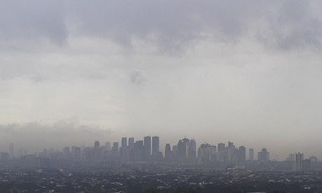
Dark clouds loom over the skyscrapers of Manila. Photograph: Rouelle Umali/REX
• In pictures: the storm rolls into Philippines
Typhoon Haiyan has hit the Philippines with winds of 195mph, with experts saying "catastrophic damage" will result from what is predicted to be the strongest tropical cyclone to make landfall in recorded history.
Thousands of people have been evacuated and thousands more have fled their homes as the category five storm sent waves as high as 5m (15ft) ashore on the islands of Leyte and Samar in the central Philippines, overturning powerlines and leaving streets knee-deep in water.
Haiyan – the Philippines' 25th typhoon so far this year – is expected to barrel through the archipelago close to Cebu, the nation's second-largest city and home to around 2.5 million people.
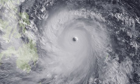 Image from Japan Meteorological Agency's MTSAT of Haiyan over the Leyte Gulf. Photograph: Zuma/rex
 With speeds at landfall of 195mph and gusts of up to 235mph, Haiyan is believed to be stronger than the world's last strongest tropical cyclone, hurricane Camille, which was recorded in the US at 190mph in 1969.
Read More Here
..........
Related articles


No comments:
Post a Comment
Hello and thank you for visiting my blog. Please share your thoughts and leave a comment :)