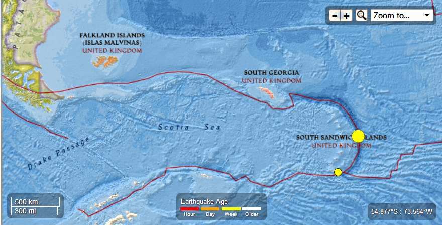
Earth Watch Report - Earthquakes

...
M6.2 - 203km NE of Bristol Island, South Sandwich Islands
2013-07-26 21:32:59 UTC

Event Time
- 2013-07-26 21:32:59 UTC
- 2013-07-26 19:32:59 UTC-02:00 at epicenter
- 2013-07-26 16:32:59 UTC-05:00 system time
Location
57.789°S 23.959°W depth=10.0km (6.2mi)Nearby Cities
- 203km (126mi) NE of Bristol Island, South Sandwich Islands
- 2715km (1687mi) ESE of Ushuaia, Argentina
- 2937km (1825mi) ESE of Rio Gallegos, Argentina
- 2952km (1834mi) ESE of Punta Arenas, Chile
- 2258km (1403mi) ESE of Stanley, Falkland Islands
...
M4.6 - 152km S of Bristol Island, South Sandwich Islands
2013-07-26 02:38:05 UTC

Event Time
- 2013-07-26 02:38:05 UTC
- 2013-07-26 00:38:05 UTC-02:00 at epicenter
- 2013-07-25 21:38:05 UTC-05:00 system time
Location
60.398°S 26.807°W depth=41.4km (25.7mi)Nearby Cities
- 152km (94mi) S of Bristol Island, South Sandwich Islands
- 2512km (1561mi) ESE of Ushuaia, Argentina
- 2756km (1712mi) SE of Punta Arenas, Chile
- 2762km (1716mi) SE of Rio Gallegos, Argentina
- 2135km (1327mi) SE of Stanley, Falkland Islands
...


No comments:
Post a Comment
Hello and thank you for visiting my blog. Please share your thoughts and leave a comment :)