Showing posts with label South Sandwich Islands. Show all posts

Saturday, July 27, 2013

South Sandwich Islands - 6.2 Magnitude and 4.6 Magnitude Earthquake July 26th, 2013

Earth Watch Report  -  Earthquakes
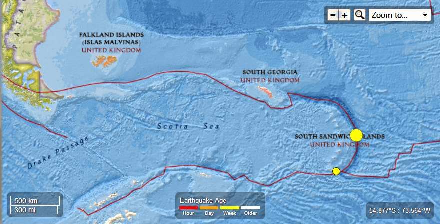

 photo SouthSandwichIslands-62MagEQJuly26th2013_zpsedd09341.jpg
...

M6.2 - 203km NE of Bristol Island, South Sandwich Islands

 2013-07-26 21:32:59 UTC

 
Earthquake location 57.789°S, 23.959°W

Event Time

  1. 2013-07-26 21:32:59 UTC
  2. 2013-07-26 19:32:59 UTC-02:00 at epicenter
  3. 2013-07-26 16:32:59 UTC-05:00 system time

Location

57.789°S 23.959°W depth=10.0km (6.2mi)

Nearby Cities

  1. 203km (126mi) NE of Bristol Island, South Sandwich Islands
  2. 2715km (1687mi) ESE of Ushuaia, Argentina
  3. 2937km (1825mi) ESE of Rio Gallegos, Argentina
  4. 2952km (1834mi) ESE of Punta Arenas, Chile
  5. 2258km (1403mi) ESE of Stanley, Falkland Islands
...

Instrumental Intensity

ShakeMap Intensity Image

...

M4.6 - 152km S of Bristol Island, South Sandwich Islands

 2013-07-26 02:38:05 UTC

Earthquake location 60.398°S, 26.807°W

Event Time

  1. 2013-07-26 02:38:05 UTC
  2. 2013-07-26 00:38:05 UTC-02:00 at epicenter
  3. 2013-07-25 21:38:05 UTC-05:00 system time

Location

60.398°S 26.807°W depth=41.4km (25.7mi)

Nearby Cities

  1. 152km (94mi) S of Bristol Island, South Sandwich Islands
  2. 2512km (1561mi) ESE of Ushuaia, Argentina
  3. 2756km (1712mi) SE of Punta Arenas, Chile
  4. 2762km (1716mi) SE of Rio Gallegos, Argentina
  5. 2135km (1327mi) SE of Stanley, Falkland Islands

...


Enhanced by Zemanta

Monday, July 15, 2013

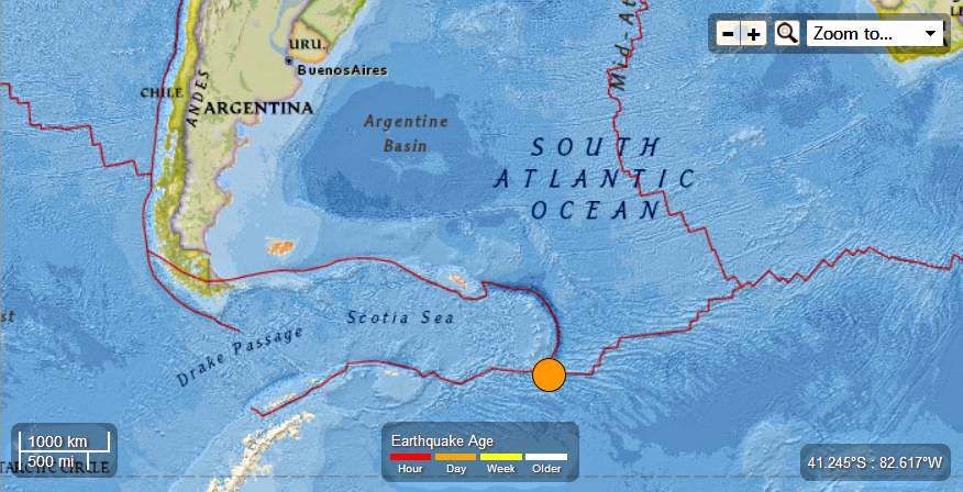
South Sandwich Islands - 7.3 Magnitude Earthquake - 216km SSE of Bristol Island

Earth Watch Report  -  Earthquakes

 photo SouthSandwichIslands-73MagEQJuly15th2013_zps223f9c99.jpg
....

M7.3 - 216km SSE of Bristol Island, South Sandwich Islands

 2013-07-15 14:03:42 UTC

Earthquake location 60.860°S, 25.189°W

Event Time

  1. 2013-07-15 14:03:42 UTC
  2. 2013-07-15 12:03:42 UTC-02:00 at epicenter
  3. 2013-07-15 09:03:42 UTC-05:00 system time

Location

60.860°S 25.189°W depth=31.3km (19.5mi)

Nearby Cities

  1. 216km (134mi) SSE of Bristol Island, South Sandwich Islands
  2. 2596km (1613mi) ESE of Ushuaia, Argentina
  3. 2841km (1765mi) SE of Punta Arenas, Chile
  4. 2851km (1772mi) SE of Rio Gallegos, Argentina
  5. 2233km (1388mi) SE of Stanley, Falkland Islands
....

Tectonic Summary

The July 15, 2013 Mw7.3 South Sandwich Islands earthquake occurred as a result of either east-west left-lateral or north-south right-lateral strike slip motion at shallow oceanic crustal depths. The earthquake occurred ~100km east of a complex plate triple junction between the South America, Antarctica, and Sandwich plates. The South America plate currently subducts beneath the Sandwich plate at a rate of ~13mm/yr while sliding past the Antarctica plate with left-lateral motion along the South Sandwich Fracture Zone at a rate of ~14mm/yr. Given the strike slip nature and location of the event, the earthquake likely resulted from relative motion between the South America and Antarctica plates. Several large earthquakes have occurred along this portion of the plate boundary, including events of Mw7.4 in January 2006 and Mw7.5 in October 1973.
....

Instrumental Intensity

ShakeMap Intensity Image
....
 photo SouthSandwichIslands-73MagEQJuly15th2013_zpsbed315ae.jpg
....
....
Enhanced by Zemanta