Showing posts with label Northeastern United States. Show all posts

Monday, February 17, 2014

No Rest for the Frigid: New Storm Brings More Snow to Northeast

deep freeze
Image: A woman walks through the snow in the Williamsburg neighborhood in the Brooklyn borough of New York
ERIC THAYER / Reuters
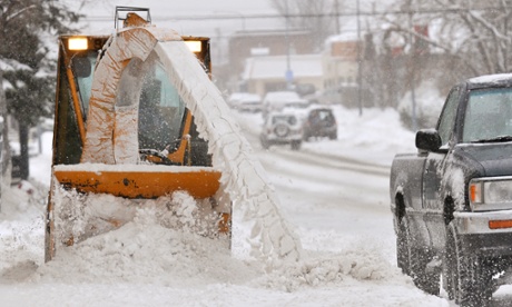


Winter administered a fresh whipping to parts of the Northeast overnight, as a new storm brought more snow and high winds to the region.
The latest blast came as residents were still digging out from a major storm that caused at least 25 deaths, and at its height, left hundreds of thousands without power on the East Coast and in the South.

New England was absorbing the worst of the weekend storm, which was moving in Saturday evening. Up to 12 inches of snow fell in eastern Massachusetts, and parts of Maine and Rhode Island overnight, Weather Channel meteorologist Mark Swaim said.
New York City and Boston, which both saw flurries overnight, were waking up to lower than average temperatures: Upper 20s in Beantown and lower 30s in the Big Apple.
Massachusetts Gov. Deval Patrick on Saturday warned drivers to stay off the roads for a 12-hour period beginning at 5 p.m., saying, "It won't be possible to keep up with the clearing of the roads."
The newest storm spawned blizzard conditions in several places along the Massachusetts coastline, including Cape Ann, Hingham, Cape Cod and surrounding islands.

Another Winter Storm Batters East Coast

Nightly News

Boston Mayor Martin Walsh announced that the city would deploy more than 600 snow plows, trucks and other equipment by Saturday evening to deal with the storm. He said additional police officers, firefighters and paramedics would be on hand throughout the storm to ensure public safety.

Southeastern New Hampshire is under a winter storm warning through Sunday that could bring 6 to 10 inches of snow. The weather service said 1 to 2 inches of snow were possible on Saturday with as much as 8 inches overnight.
Further south, New York City New York City's Central Park received 1 1/2 inches of new snow after getting nearly a foot of snow Thursday.


.....

Boston Weather Forecast: Snow From Winter Storm Hits New England


Good Samaritans help push a stranded motorist stuck in deep snow on Stefko Boulevard Thursday, Feb. 13, 2014 in Bethlehem, Pa.  A wide swath of Pennsylvania awoke Thursday to a fresh coating of snow and a forecast for much more to come over the course of the day. (AP Photo/Chris Post)
Good Samaritans help push a stranded motorist stuck in deep snow on Stefko Boulevard Thursday, Feb. 13, 2014 in Bethlehem, Pa. A wide swath of Pennsylvania awoke Thursday to a fresh coating of snow and a forecast for much more to come over the course of the day. (AP Photo/Chris Post)
BOSTON (AP) — Another winter storm began hitting southern New England on Saturday afternoon and meteorologists said the region will experience heavy snow, strong winds and blizzard conditions near the Massachusetts coast before the storm clears out on Sunday.
The National Weather Service said Massachusetts and parts of Rhode Island will bear the brunt of the storm, with 10 to 14 inches of snow.
“Connecticut will see heaviest snowfall amounts near the Rhode Island border, with lesser amounts as you head further west,” meteorologist William Babcock said. “So there might be 8 to 10 inches right along the Rhode Island border, maybe 4 to 6 around Willimantic and 2 to 4 around Hartford.”
At its peak, the storm will dump snow at the rate of up to 3 inches per hour, Babcock said.
Massachusetts Gov. Deval Patrick urged drivers to stay off the roads from 5 p.m. Saturday to 5 a.m. Sunday, and said “it won’t be possible to keep up with the clearing of the roads” during the storm.
The storm is expected to spawn blizzard conditions in several spots along the eastern Massachusetts coastline, including Cape Ann, Hingham, Cape Cod and surrounding islands.
“These areas could be seeing winds reaching up to 70mph, blowing snow and creating extremely poor visibility,” Babcock said. “People should be preparing for deteriorating conditions … People should be ready to stay off the roads and the good thing is a lot of this will be at night, when people are normally off the roads.”
The Rhode Island coast areas north and northwest of Boston will experience winds of up to 45mph that will blow the snow and create chilly conditions.


Read More Here
.....
Enhanced by Zemanta

Saturday, January 4, 2014

US grapples with snow as 'polar vortex' of subzero temperatures approaches


• 16 dead after storm drops heavy snow along north-east
• Midwest braces for 'life-threatening' winds and cold
Snow makes it way down to the platform of the 65th Street subway station during a winter storm in New York, 3 January, 2014
Snow makes it way down to the platform of the 65th Street subway station during a winter storm in New York. Photograph: Zoran Milich/Reuters
At least 16 people died as a result of the winter storm which hit the north-eastern US on Friday, authorities said. But as the cleanup from near-blizzard conditions continued, in temperatures as low as -9.4F (-23C), forecasters warned of worse to come for the midwest on Sunday.
One meteorologist, Ryan Maue of Weather Bell, called the system of cold air approaching the midwest a “polar vortex”. “All the ingredients are there for a near-record or historic cold outbreak,” he said. “If you're under 40, you've not seen this stuff before.”
The temperature was predicted to fall as low as -31F (-35C) in parts of Minnesota, with wind chill potentially making that feel like -69F (-56C). In a region accustomed to brutally cold weather, however, the Green Bay Packers' NFL wild-card playoff game against the San Francisco 49ers at Lambeau Field in Wisconsin is expected to go ahead on Sunday evening, as the coldest NFL game ever played. Forecasters said it would be -2F (-19C) at kickoff (4.45pm ET) and -8F (-22C) by the fourth quarter.
Fans – who bought the remaining 40,000 tickets this week after the NFL threatened to prohibit local TV from airing the game if the team was unable to sell out – were warned to take extra precautions, such as dressing in layers and sipping warm drinks.
Delays and cancellations continued to affect air and road transport. By midday Saturday, nearly 1,000 flights had been cancelled and 4,200 delayed across the US. More than 180 flights out of O'Hare International Airport, in Chicago, had been cancelled.
In Minnesota, Governor Mark Dayton ordered schools closed across the state for the first time in 17 years. In North Dakota, "life threatening wind chills" were forecast through Tuesday morning. Experts said that in such conditions, frostbite could set in on exposed skin within five minutes.
Maue added that though the cold spell approaching the midwest would last for only a few days, “it raises the chances for future cold” across the country.
The NFL is watching such forecasts closely, as it has scheduled Super Bowl XLVIII to be played on 2 February at MetLife Stadium in New Jersey, the outdoor venue shared by the New York Jets and the New York Giants. Contingency plans are in place to play the showpiece game, which is usually staged at warm-weather venues or in domed stadiums, on 1 or 3 February if necessary.
"Right now for the winter we will have had two significant shots of major Arctic air and we're only through the first week of January,” said Maue. “And we had a pretty cold December.”
The cold blast will also affect parts of the east coast still clearing up from Friday's storm. Sally Johnson, a meteorologist at the National Weather Service in Sioux Falls, said: "This one happens to be really big and it's going to dive deep into the continental US. And all that cold air is going to come with it."

Read More Here

.....

Snowstorm slams north-eastern United States

Updated Sat 4 Jan 2014, 12:33am AEDT
A major snowstorm has hit the north-eastern United States, blasting brutal wintry weather on many states and major cites, and delaying or cancelling thousands of flights.
The storm has caused more than 1,700 US flight delays and cancellations, paralysed road travel, and closed schools and government offices.
The governors of New York and New Jersey have declared a state of emergency and pleaded with residents to stay indoors.
The National Weather Service has issued winter storm warnings and advisories for a huge area including Chicago, New York, New England and Washington DC.
Severe weather is also hitting the country's Midwest, dropping a blanket of snow and cancelling flights at Chicago's O'Hare International Airport.

Temperatures in New York are expected to drop to -13 degrees Celsius, and forecasters predict 10 to 20 centimetres of snow, and winds that could reach up to 56 kilometres per hour.
The National Weather Service says blizzard conditions are possible for eastern Long Island and the coast of Massachusetts.
"Bitter cold will move into the Midwest and East following the storm," it warned.

Read More Here

.....
Enhanced by Zemanta

Thursday, January 2, 2014

Winter storm set to bring foot of snow and frigid temperatures to US east


• State of emergency declared in New York state
• New York mayor De Blasio: 'We have to be ready for this'
Do you live in the storm's path? Share your photos
Winter storm US
Road travel is expected to be severely affected. Photograph: Mark Sauer/AP
A state of emergency was declared in New York state on Thursday afternoon as cities across mid-west and north-east US braced for a severe snow storm and extreme cold.
More than 10 inches of snow was expected in New York City and up to 14 inches in Boston, with weather warnings affecting more than 100 million people in cities across the region.
The storm is expected to move across more than a dozen states. Heavy snow and strong winds are expected across the north-east through Thursday evening and into Friday.
The National Weather Service warned that bitter cold will move in following the storms, as it forecast temperatures 20 to 30F below normal. The NWS warned of “the most frigid conditions” in years in New York City and elsewhere in the state. Blizzards were expected along stretches of the eastern seaboard, from Long Island in New York to Boston.
New York governor Andrew Cuomo announced a “statewide state of emergency” just before 4pm on Thursday. He warned motorists to “stay off the roads if you can”.
At an early evening briefing the new mayor of New York City, Bill de Blasio, said a decision on whether to close New York City's public schools would be taken in the early hours of Friday morning. De Blasio also said New Yorkers should use mass transit rather than drive, but warned that people should expect delays.
In Massachusetts, state workers were sent home at 3pm and the state’s governor, Deval Patrick, urged private employers to do the same. The Massachusetts emergency management agency said it would be at level three, indicating that local state of emergencies would be declared and that state and federal recovery assistance would be required.
"Temperatures are expected to plummet tonight and tomorrow with wind chills dropping as low as 25 degrees below zero [Fahrenheit, -32C)],” Patrick said. "That is a very dangerous set of circumstances."
Weather advisories have been put in place from Chicago eastward. The more severe winter storm warnings were in effect in New York, New Jersey, Pennsylvania, Michigan, Indiana, Ohio, North Carolina, West Virginia, Connecticut, Massachusetts, New Hampshire, Vermont and Maine on Thursday.

Read More Here

.....

WSJ

Winter Storm Headed for New York

Almost 10 Inches of Snow and Wind Chills Below Zero Are Expected in Parts of New York

Updated Jan. 2, 2014 5:31 p.m. ET
The first snowstorm of 2014 is heading for the U.S. northeast, with more than six inches of snow expected in New York and southern New England before Saturday. Photo: Associated Press.
New York City-area authorities on Thursday urged residents to stay home, ordered highways be shut down and scaled back some mass-transit service as a dangerous snowstorm barreled into the region from the Midwest.
One day into his new job, the city's mayor, Bill de Blasio, said the Department of Sanitation was ready for a nor'easter predicted to dump a half a foot or more of snow on the city. The storm was expected to be the first test of the de Blasio's administration, and the city had mobilized about 2,300 sanitation workers for each 12-hour shift, 450 salt spreaders and 1,700 trucks with plows.
With the storm approaching, Marco Iuele inspects a salt spreader while shopping at Meadowlands Hardware in East Rutherford, N.J., on Thursday. Associated Press

"We are not taking anything lightly," Mr. de Blasio said, adding the city had "all hands on deck."
The National Weather Service predicted treacherous conditions, with wind gusts from 25 to 30 miles an hour and wind chills below zero. By late Thursday, weather service officials reported about two inches of snow, with wind gusts of 40 mph or more in New York City and Long Island. Temperatures were in the low 20s, with wind chill around 5 degrees. States of emergency were declared in New York and New Jersey.
"Exposed skin could start to freeze within 15 minutes," said Tim Morrin, a meteorologist at the National Weather Service.
Mr. de Blasio advised New Yorkers to expect schools to be open tomorrow, but a final decision there—and throughout much of the region—would be made early Friday morning. Some school districts in Northern New Jersey announced they would be closed Friday.
The brunt of the storm was expected to be felt in Long Island, where up to 10 inches of snow were predicted, and upstate New York, where authorities were expecting 14 inches in some places. Gov. Andrew Cuomo shut down the Long Island Expressway and parts of Interstate 87—two vital commercial arteries in and out of the city—beginning at midnight on Friday.
A pedestrian walks through morning snow in Albany Thursday. Associated Press
Nassau County Executive Ed Mangano said he expected the LIE to be opened for the morning commute, but added that was a decision for Mr. Cuomo. Road crews were out early Thursday morning on Long Island to brine roads, which raises asphalt temperature and prevents icing.
The storm is an early test for PSEG Long Island, the utility that took over management of Long Island's electric grid on Jan. 1. The Long Island Power Authority, PSEG's predecessor, faced criticism of its storm preparation and response in recent years—a major factor in the state's decision to switch to a new utility. "It is two days in, but we have pulled together a team that I think is one of the best in the country," said Paul Rosengren, a PSEG spokesman.
The Department of Sanitation keeps tons of salt in a building at 2 Bloomfield St. on the West Side. Philip Montgomery for The Wall Street Journal
PSEG and other utility companies across the region were ordering extra crews in case of widespread outages. Officials said the scope of power failures would depend on how wet and heavy the snow was and whether it would weigh down electricity lines.


.....

Enhanced by Zemanta