Showing posts with label Kamchatka Peninsula. Show all posts

Wednesday, November 13, 2013

Russia - 6.6 Magnitude Earthquake - 172km S of Ust'-Kamchatsk Staryy

Earth Watch Report

Russia  -  6.6 Mag EQ  November 12th  2013 photo Russia-66MagEQNovember12th2013_zpsf0430164.jpg
.....

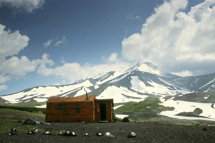
M 6.6 - 172km S of Ust'-Kamchatsk Staryy, Russia

 2013-11-12 07:03:51 UTC


Earthquake location 54.681°N, 162.286°E

Event Time

  1. 2013-11-12 07:03:51 UTC
  2. 2013-11-12 19:03:51 UTC+12:00 at epicenter
  3. 2013-11-12 01:03:51 UTC-06:00 system time

Location

54.681°N 162.286°E depth=47.2km (29.3mi)

Nearby Cities

  1. 172km (107mi) S of Ust'-Kamchatsk Staryy, Russia
  2. 300km (186mi) NE of Petropavlovsk-Kamchatskiy, Russia
  3. 305km (190mi) NE of Yelizovo, Russia
  4. 321km (199mi) NE of Vilyuchinsk, Russia
  5. 2733km (1698mi) NNE of Tokyo, Japan
.....

Tectonic Summary

Seismotectonics of the Kuril-Kamchatka Arc

The Kuril-Kamchatka arc extends approximately 2,100 km from Hokkaido, Japan, along the Kuril Islands and the Pacific coast of the Kamchatka Peninsula to its intersection with the Aleutian arc near the Commander Islands, Russia. It marks the region where the Pacific plate subducts into the mantle beneath the Okhotsk microplate, part of the larger North America plate. This subduction is responsible for the generation of the Kuril Islands chain, active volcanoes located along the entire arc, and the deep offshore Kuril-Kamchatka trench. Relative to a fixed North America plate, the Pacific plate is moving towards the northwest at a rate that increases from 75 mm/year near the northern end of the arc to 83 mm/year in the south.
Plate motion is predominantly convergent along the Kuril-Kamchatka arc with obliquity increasing towards the southern section of the arc. The subducting Pacific plate is relatively old, particularly adjacent to Kamchatka where its age is greater than 100 Ma. Consequently, the Wadati-Benioff zone is well defined to depths of approximately 650 km. The central section of the arc is comprised of an oceanic island arc system, which differs from the continental arc systems of the northern and southern sections. Oblique convergence in the southern Kuril arc results in the partitioning of stresses into both trench-normal thrust earthquakes and trench-parallel strike-slip earthquakes, and the westward translation of the Kuril forearc. This westward migration of the Kuril forearc currently results in collision between the Kuril arc in the north and the Japan arc in the south, resulting in the deformation and uplift of the Hidaka Mountains in central Hokkaido.
The Kuril-Kamchatka arc is considered one of the most seismically active regions in the world. Deformation of the overriding North America plate generates shallow crustal earthquakes, whereas slip at the subduction zone interface between the Pacific and North America plates generates interplate earthquakes that extend from near the base of the trench to depths of 40 to 60 km. At greater depths, Kuril-Kamchatka arc earthquakes occur within the subducting Pacific plate and can reach depths of approximately 650 km.
This region has frequently experienced large (M>7) earthquakes over the past century. Since 1900, seven great earthquakes (M8.3 or larger) have also occurred along the arc, with mechanisms that include interplate thrust faulting, and intraplate faulting. Damaging tsunamis followed several of the large interplate megathrust earthquakes. These events include the February 3, 1923 M8.4 Kamchatka, the November 6,1958 M8.4 Etorofu, and the September 25, 2003 M8.3 Hokkaido earthquakes. A large M8.5 megathrust earthquake occurred on October 13, 1963 off the coast of Urup, an island along the southern Kuril arc, which generated a large tsunami in the Pacific Ocean and the Sea of Okhotsk, and caused run-up wave heights of up to 4-5 m along the Kuril arc. The largest megathrust earthquake to occur along the entire Kurile-Kamchatka arc in the 20th century was the November 4, 1952 M9.0 event. This earthquake was followed by a devastating tsunami with run-up wave heights as high as 12 m along the coast of Paramushir, a small island immediately south of Kamchatka, causing significant damage to the city of Severo-Kurilsk.
On October 4,1994, a large (M8.3) intraplate event occurred within the subducted oceanic lithosphere off the coast of Shikotan Island causing intense ground shaking, landslides, and a tsunami with run-up heights of up to 10 m on the island.
The most recent megathrust earthquake in the region was the November 15, 2006 M8.3 Kuril Island event, located in the central section of the arc. Prior to this rupture, this part of the subduction zone had been recognized as a seismic gap spanning from the northeastern end of the 1963 rupture zone to the southwestern end of the 1952 rupture. Two months after the 2006 event, a great (M8.1) normal faulting earthquake occurred on January 13, 2007 in the adjacent outer rise region of the Pacific plate. It has been suggested that the 2007 event may have been caused by the stresses generated from the 2006 earthquake.
More information on regional seismicity and tectonics
.....

Instrumental Intensity

ShakeMap Intensity Image
.....
Russia  -  6.6 Mag EQ  November 12th  2013 photo Russia-66MagEQNovember12th2013_zps3b70ceaf.jpg
.....
Enhanced by Zemanta

Monday, August 5, 2013

Volcano Activity - Russia [Asia], Kamchatka Krai, [Avachinsky volcano]

Earth Watch Report  -  Volcanic  Activity

File:Avachinsky Volcano.jpg
Image Source  :  Wikipedia
Jan van der Crabben (Photographer)
...
 04.08.2013Volcano ActivityRussia [Asia]Kamchatka Krai, [Avachinsky volcano]Damage level Details
...

Volcano Activity in Russia [Asia] on Sunday, 04 August, 2013 at 04:41 (04:41 AM) UTC.

Description
A (so far small) seismic crisis has started about a week ago. The earthquake hypocenters are currently located at depths around 30 km SE of the volcano. The new quakes superimpose to the normal seismic activity at shallow depth. It is not clear whether this indicates that magma has started to accumulate at the mantle-crust boundary beneath the volcano, or whether the seismic activity there is purely tectonic and related to the subduction of the Pacific Plate. Currently, there are no indications that the volcano might be in for a new eruption, but since Avachinsky is located very close to Kamchatka's capital town of Petropavlovsk with 200,000 inhabitants, it is being monitored closely by Russian scientists. As Blog Culture Volcan who posted about this story first pointed out, recent studies on the magma plumbing system of Avachinsky show that the volcano's recent eruptions, at least the one in 1991, were fueled by at least two different shallow magma chambers: These are located at 1.8 and 5.5 km depth beneath the summit, and correspond to the boundaries between the floor of the caldera (formed about 30,000 years ago) and the present summit cone, and the contact of the volcanic edifice as a whole overlying carbonate sediment basement, respectively. In both cases, the geologic contact between of different rock types with different densities and structures seem to stop dike propagation and act as storage regions for magma. On the other hand, no deeper magma reservoir has been identified for Avachinsky, and no progression of epicenter depths towards the surface has been seen for the recent deep quakes. This favors the interpretation that the observed quakes are mainly tectonic in origin.
...

Avachinsky volcano (Kamchatka): deep earthquake swarm

Friday Aug 02, 2013 07:58 AM | BY: T
Location of recent quakes under Avachinsky (blue dots) (EMSD)
A (so far small) seismic crisis has started about a week ago. The earthquake hypocenters are currently located at depths around 30 km SE of the volcano.
The new quakes superimpose to the normal seismic activity at shallow depth. It is not clear whether this indicates that magma has started to accumulate at the mantle-crust boundary beneath the volcano, or whether the seismic activity there is purely tectonic and related to the subduction of the Pacific Plate.
Currently, there are no indications that the volcano might be in for a new eruption, but since Avachinsky is located very close to Kamchatka's capital town of Petropavlovsk with 200,000 inhabitants, it is being monitored closely by Russian scientists.
As Blog Culture Volcan who posted about this story first pointed out, recent studies on the magma plumbing system of Avachinsky show that the volcano's recent eruptions, at least the one in 1991, were fueled by at least two different shallow magma chambers:


Read More Here
...
...
Enhanced by Zemanta

Russia - 5.8 Magnitude Earthquake - 196km ESE of Dolinsk and a 4.6 Magnitude Earthquake - 78km SSE of Kuril'sk

Earth Watch Report  -  Earthquakes

 photo Russia-58and46MagEQAugust4th2013_zps23737d2b.jpg
...

M5.8 - 196km ESE of Dolinsk, Russia

 2013-08-04 15:56:34 UTC

Earthquake location 46.947°N, 145.329°E

Event Time

  1. 2013-08-04 15:56:34 UTC
  2. 2013-08-05 01:56:34 UTC+10:00 at epicenter
  3. 2013-08-04 10:56:34 UTC-05:00 system time

Location

46.947°N 145.329°E depth=367.4km (228.3mi)

Nearby Cities

  1. 196km (122mi) ESE of Dolinsk, Russia
  2. 197km (122mi) E of Yuzhno-Sakhalinsk, Russia
  3. 197km (122mi) E of Korsakov, Russia
  4. 249km (155mi) E of Kholmsk, Russia
  5. 1335km (830mi) NNE of Tokyo, Japan
...

M4.6 - 78km SSE of Kuril'sk, Russia

 2013-08-04 17:10:02 UTC

Earthquake location 44.548°N, 148.132°E

Event Time

  1. 2013-08-04 17:10:02 UTC
  2. 2013-08-05 03:10:02 UTC+10:00 at epicenter
  3. 2013-08-04 12:10:02 UTC-05:00 system time

Location

44.548°N 148.132°E depth=60.9km (37.8mi)

Nearby Cities

  1. 78km (48mi) SSE of Kuril'sk, Russia
  2. 246km (153mi) NE of Nemuro, Japan
  3. 259km (161mi) ENE of Shibetsu, Japan
  4. 313km (194mi) ENE of Abashiri, Japan
  5. 1217km (756mi) NNE of Tokyo, Japan
...

Tectonic Summary

Seismotectonics of the Kuril-Kamchatka Arc

The Kuril-Kamchatka arc extends approximately 2,100 km from Hokkaido, Japan, along the Kuril Islands and the Pacific coast of the Kamchatka Peninsula to its intersection with the Aleutian arc near the Commander Islands, Russia. It marks the region where the Pacific plate subducts into the mantle beneath the Okhotsk microplate, part of the larger North America plate. This subduction is responsible for the generation of the Kuril Islands chain, active volcanoes located along the entire arc, and the deep offshore Kuril-Kamchatka trench. Relative to a fixed North America plate, the Pacific plate is moving towards the northwest at a rate that increases from 75 mm/year near the northern end of the arc to 83 mm/year in the south.
Plate motion is predominantly convergent along the Kuril-Kamchatka arc with obliquity increasing towards the southern section of the arc. The subducting Pacific plate is relatively old, particularly adjacent to Kamchatka where its age is greater than 100 Ma. Consequently, the Wadati-Benioff zone is well defined to depths of approximately 650 km. The central section of the arc is comprised of an oceanic island arc system, which differs from the continental arc systems of the northern and southern sections. Oblique convergence in the southern Kuril arc results in the partitioning of stresses into both trench-normal thrust earthquakes and trench-parallel strike-slip earthquakes, and the westward translation of the Kuril forearc. This westward migration of the Kuril forearc currently results in collision between the Kuril arc in the north and the Japan arc in the south, resulting in the deformation and uplift of the Hidaka Mountains in central Hokkaido.
The Kuril-Kamchatka arc is considered one of the most seismically active regions in the world. Deformation of the overriding North America plate generates shallow crustal earthquakes, whereas slip at the subduction zone interface between the Pacific and North America plates generates interplate earthquakes that extend from near the base of the trench to depths of 40 to 60 km. At greater depths, Kuril-Kamchatka arc earthquakes occur within the subducting Pacific plate and can reach depths of approximately 650 km.
This region has frequently experienced large (M>7) earthquakes over the past century. Since 1900, seven great earthquakes (M8.3 or larger) have also occurred along the arc, with mechanisms that include interplate thrust faulting, and intraplate faulting. Damaging tsunamis followed several of the large interplate megathrust earthquakes. These events include the February 3, 1923 M8.4 Kamchatka, the November 6,1958 M8.4 Etorofu, and the September 25, 2003 M8.3 Hokkaido earthquakes. A large M8.5 megathrust earthquake occurred on October 13, 1963 off the coast of Urup, an island along the southern Kuril arc, which generated a large tsunami in the Pacific Ocean and the Sea of Okhotsk, and caused run-up wave heights of up to 4-5 m along the Kuril arc. The largest megathrust earthquake to occur along the entire Kurile-Kamchatka arc in the 20th century was the November 4, 1952 M9.0 event. This earthquake was followed by a devastating tsunami with run-up wave heights as high as 12 m along the coast of Paramushir, a small island immediately south of Kamchatka, causing significant damage to the city of Severo-Kurilsk.
On October 4,1994, a large (M8.3) intraplate event occurred within the subducted oceanic lithosphere off the coast of Shikotan Island causing intense ground shaking, landslides, and a tsunami with run-up heights of up to 10 m on the island.
The most recent megathrust earthquake in the region was the November 15, 2006 M8.3 Kuril Island event, located in the central section of the arc. Prior to this rupture, this part of the subduction zone had been recognized as a seismic gap spanning from the northeastern end of the 1963 rupture zone to the southwestern end of the 1952 rupture. Two months after the 2006 event, a great (M8.1) normal faulting earthquake occurred on January 13, 2007 in the adjacent outer rise region of the Pacific plate. It has been suggested that the 2007 event may have been caused by the stresses generated from the 2006 earthquake.
More information on regional seismicity and tectonics
...

Instrumental Intensity

ShakeMap Intensity Image
...

5.5 Magnitude Earthquake in Russia Rattled the Countryside

quake21
Sunday in Russia, a magnitude 5.5 earthquake occurred, which rattled the remote countryside. It happened at 10:56 UTC, at 46.919°N 145.291°E and a depth of 379.4 km (235.7 mi).
The three closest cities to the quake’s epicenter were Yuzhno-Sakhalinsk, Korsakov, and Dolininsk. Each was 194 km (121 mi) away from the epicenter, so were largely unaffected by the earthquake.
The moderate earthquake’s epicenter places it in the seismotectonically active area of the Kuri-Kamchatka arc. It extends approximately 2,100 km from Hokkaido, Japan, along the Kuril Islands  and the Pacific coast of the Kamchatka Peninsula to its intersection with the Aleutian arc near the Commander Islands, Russia.
This is the area where the Pacific plate subducts into the mantle beneath the Okhotsk microplate, part of the larger North America plate. This subduction is responsible for the generation of the Kuril Islands chain, which are actually active volcanoes located along the entire arc, and the deep offshore Kuril-Kamchatka trench.
The central section of the arc is comprised of an oceanic island arc system. This differs from the continental arc systems of the northern and southern sections.
Oblique convergence in the southern Kuril arc results in the partitioning of stresses into both trench-normal thrust earthquakes and trench-parallel strike-slip earthquakes, as well as the westward movement of the Kuril forearc.


Read More Here


...
Enhanced by Zemanta

Thursday, August 1, 2013

Russia - 5.1 Magnitude Earthquake - 120km S of Severo-Kuril'sk

Earth watch Report  -  Earthquakes


 photo Russia-51MagEQAugust1st2013_zpsac50bc75.jpg
...

M5.1 - 120km S of Severo-Kuril'sk, Russia

 2013-08-01 16:39:59 UTC

Earthquake location 49.592°N, 156.111°E

Event Time

  1. 2013-08-01 16:39:59 UTC
  2. 2013-08-02 02:39:59 UTC+10:00 at epicenter
  3. 2013-08-01 11:39:59 UTC-05:00 system time

Location

49.592°N 156.111°E depth=56.5km (35.1mi)

Nearby Cities

  1. 120km (75mi) S of Severo-Kuril'sk, Russia
  2. 404km (251mi) SSW of Vilyuchinsk, Russia
  3. 422km (262mi) SSW of Petropavlovsk-Kamchatskiy, Russia
  4. 429km (267mi) SSW of Yelizovo, Russia
  5. 2039km (1267mi) NE of Tokyo, Japan
...

Tectonic Summary

Seismotectonics of the Kuril-Kamchatka Arc

The Kuril-Kamchatka arc extends approximately 2,100 km from Hokkaido, Japan, along the Kuril Islands and the Pacific coast of the Kamchatka Peninsula to its intersection with the Aleutian arc near the Commander Islands, Russia. It marks the region where the Pacific plate subducts into the mantle beneath the Okhotsk microplate, part of the larger North America plate. This subduction is responsible for the generation of the Kuril Islands chain, active volcanoes located along the entire arc, and the deep offshore Kuril-Kamchatka trench. Relative to a fixed North America plate, the Pacific plate is moving towards the northwest at a rate that increases from 75 mm/year near the northern end of the arc to 83 mm/year in the south.
Plate motion is predominantly convergent along the Kuril-Kamchatka arc with obliquity increasing towards the southern section of the arc. The subducting Pacific plate is relatively old, particularly adjacent to Kamchatka where its age is greater than 100 Ma. Consequently, the Wadati-Benioff zone is well defined to depths of approximately 650 km. The central section of the arc is comprised of an oceanic island arc system, which differs from the continental arc systems of the northern and southern sections. Oblique convergence in the southern Kuril arc results in the partitioning of stresses into both trench-normal thrust earthquakes and trench-parallel strike-slip earthquakes, and the westward translation of the Kuril forearc. This westward migration of the Kuril forearc currently results in collision between the Kuril arc in the north and the Japan arc in the south, resulting in the deformation and uplift of the Hidaka Mountains in central Hokkaido.
The Kuril-Kamchatka arc is considered one of the most seismically active regions in the world. Deformation of the overriding North America plate generates shallow crustal earthquakes, whereas slip at the subduction zone interface between the Pacific and North America plates generates interplate earthquakes that extend from near the base of the trench to depths of 40 to 60 km. At greater depths, Kuril-Kamchatka arc earthquakes occur within the subducting Pacific plate and can reach depths of approximately 650 km.
This region has frequently experienced large (M>7) earthquakes over the past century. Since 1900, seven great earthquakes (M8.3 or larger) have also occurred along the arc, with mechanisms that include interplate thrust faulting, and intraplate faulting. Damaging tsunamis followed several of the large interplate megathrust earthquakes. These events include the February 3, 1923 M8.4 Kamchatka, the November 6,1958 M8.4 Etorofu, and the September 25, 2003 M8.3 Hokkaido earthquakes. A large M8.5 megathrust earthquake occurred on October 13, 1963 off the coast of Urup, an island along the southern Kuril arc, which generated a large tsunami in the Pacific Ocean and the Sea of Okhotsk, and caused run-up wave heights of up to 4-5 m along the Kuril arc. The largest megathrust earthquake to occur along the entire Kurile-Kamchatka arc in the 20th century was the November 4, 1952 M9.0 event. This earthquake was followed by a devastating tsunami with run-up wave heights as high as 12 m along the coast of Paramushir, a small island immediately south of Kamchatka, causing significant damage to the city of Severo-Kurilsk.
On October 4,1994, a large (M8.3) intraplate event occurred within the subducted oceanic lithosphere off the coast of Shikotan Island causing intense ground shaking, landslides, and a tsunami with run-up heights of up to 10 m on the island.
The most recent megathrust earthquake in the region was the November 15, 2006 M8.3 Kuril Island event, located in the central section of the arc. Prior to this rupture, this part of the subduction zone had been recognized as a seismic gap spanning from the northeastern end of the 1963 rupture zone to the southwestern end of the 1952 rupture. Two months after the 2006 event, a great (M8.1) normal faulting earthquake occurred on January 13, 2007 in the adjacent outer rise region of the Pacific plate. It has been suggested that the 2007 event may have been caused by the stresses generated from the 2006 earthquake.

More information on regional seismicity and tectonics
...
...
...
Enhanced by Zemanta