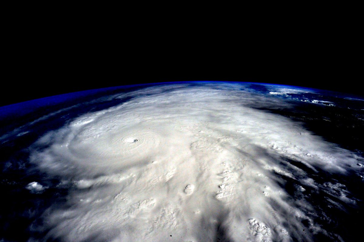
Hurricane
Patricia 2015, the strongest storm ever, grew into a Category 5 on
Mexico’s central Pacific Coast late Thursday for what forecasters said
could be a devastating blow, as officials declared a state of emergency and handed out sandbags in preparation for flooding, according to Bloomberg.
Steady rain began to fall after dark in Manzanillo, one of the country’s principal ports, ahead of an expected landfall Friday. Luis Felipe Puente, Mexico’s civil defense coordinator, said schools would be closed in Colima state, which is home to Manzanillo.
“We are calm,” said Gabriel Lopez, a worker at Las Hadas Hotel in the city. “We don’t know what direction (the storm) will take, but apparently it’s headed this way. … If there is an emergency we will take care of the people. There are rooms that are not exposed to wind or glass.”
The U.S. National Hurricane Center in Miami warned that preparations should be rushed to completion, saying Hurricane Patricia could cause coastal flooding, destructive waves and flash floods.
“This is an extremely dangerous, potentially catastrophic hurricane,” center meteorologist Dennis Feltgen said.
Read More Here
..........
Hurricane Patricia: Strongest Storm Ever Measured to Hit Mexico
More than 7 million residents — and an estimated tens of thousands of U.S. citizens visiting or living there — were told to prepare for the "worst-case scenario" as the ferocious storm was expected to race ashore on Mexico's Pacific coast between 6 to 10 p.m. ET Friday.
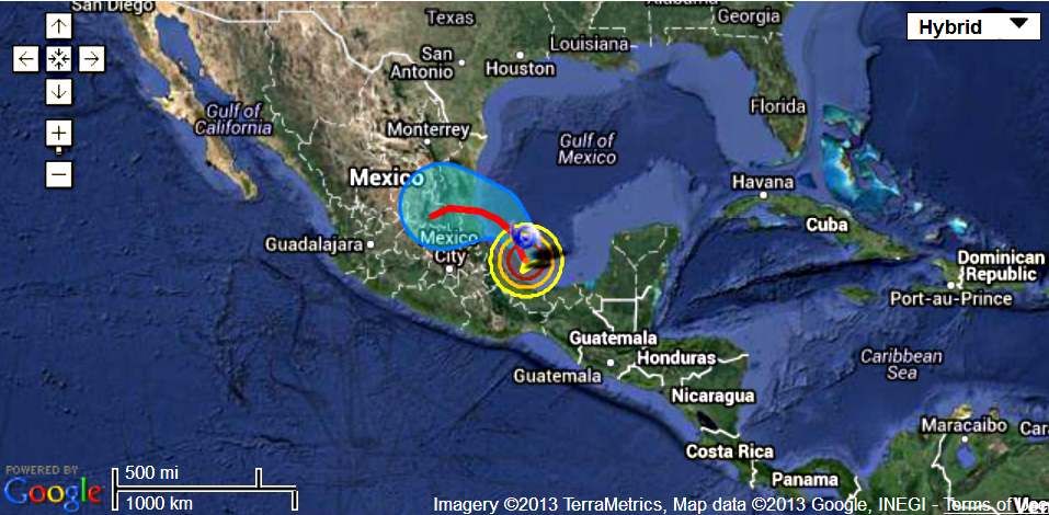
At 5 p.m. ET, Patricia was about 60 miles west of Manzanillo, and about 110 miles south-southeast of Cabo Corrientes.
The U.S. National Hurricane Center said Patricia was expected to make landfall "in the next several hours." A hurricane warning was in place for San Blas to Punta San Telmo.
The tourist magnets of Puerto Vallarta and Manzanillo were directly in the Category 5 storm's projected path, and Puerto Vallarta's airport was closed Friday out of precaution as some stranded vacationers described their inability to fly out of a "nightmare."
By 5 p.m. winds had weakened slightly to 190 mph, the Hurricane Center said. Winds of 200 mph were measured earlier, and the Hurricane Center labeled Patricia as the "strongest hurricane on record" in the Atlantic and eastern North Pacific Basins.
Mexico has not formally requested help from the U.S., but State Department spokesman Mark Toner told reporters Friday that America "stands up to offer any assistance that we can in the aftermath of what at least appears to be a pretty epic event in terms of the intensity and size of the storm."
Read More and Watch Videos Here
..........
'Extraordinarily Dangerous' Category 5 Hurricane Patricia Makes Landfall in Mexico
Hurricane Patricia made landfall near Cuixmala, west-northwest of Manzanillo, carrying 165 mph winds at 6:15 p.m. local time (7:15 p.m. ET), according to the National Hurricane Center. Palm trees bent and rain whipped in sideways as the storm made its first appearance on land.
Patricia's "potentially catastrophic landfall" would affect a stretch of coast between the popular tourist destinations of Puerto Vallarta and Manzanillo, the World Meteorological Organization said. Hurricane force winds covered 35 miles, while tropical storm force winds extended 175 miles, according to the NHC.
More than 7 million people were in the storm's path.
Jalisco was already seeing destruction from the storm Friday afternoon, according to state police. The state, which encompasses Puerto Vallarta and the Guadalajara metro area, had 1,075 shelters set up, according to the Ministry of Communications and Transportation.
About 3,500 people were evacuated from the region ahead of the storm, and airlifts were prepared to rescue people from the region on Saturday.
Read More nd Watch Videos Here
..........
New York Times
MEXICO CITY — The strongest hurricane to ever assault the Western Hemisphere slammed into Mexico’s
southwest Pacific Coast on Friday evening, transforming hotels into
makeshift shelters, shuttering schools, closing airports and sending
inhabitants racing to bus stations to flee inland.
The
storm, named Hurricane Patricia, was packing winds of about 165 miles
per hour as it struck land, having slowed considerably from earlier
speeds of about 200 miles per hour as it spun toward a coastline dotted
with tiny fishing villages and five-star resorts in cities like Puerto
Vallarta.
As
the outer wall of the hurricane swept over the coast at 6:15 p.m., the
authorities reported trees being knocked down and landslides taking
place along the road between the city of Colima and the port city of
Manzanillo. Light poles were quickly toppled and roofs torn off.
Less than an hour later, the National Hurricane Center said the hurricane was barreling inland over southwestern Mexico with maximum sustained wind speeds of 160 m.p.h. and remained “extremely dangerous.”

The
government of Mexico had already declared a state of emergency in
dozens of municipalities in the states of Colima, Nayarit and Jalisco.
Residents had stacked sandbags around properties and rushed to grocery
stores to stock up on supplies.
By
noon, there were no more bus tickets to buy or gas to pump in order to
evacuate, some residents said. Lines at neighborhood grocery stores,
hours long earlier in the day, suddenly disappeared. Those who made it
out were long gone. The rest were stuck to weather out the monster
storm.

 By:
By: 


