Showing posts with label Taiwan. Show all posts

Friday, December 11, 2015

Biological Hazard - Taiwan, Changzhi, Pingtung County : H5N8 (highly pathogenic avian influenza virus)


..........

Taiwan Hit by Six More Bird Flu Outbreaks
ThePoultrySite.com - news, features, articles and disease information for the poultry industry

............

............
Biological Hazard in Taiwan on December 11 2015 04:45 AM (UTC).
 

Base data

EDIS NumberBH-20151211-51211-TWN
Event typeBiological Hazard
Date/TimeDecember 11 2015 04:45 AM (UTC)
Last updateDecember 11 2015 04:46 AM (UTC)
Cause of event 
Damage levelIs not or not known Damage level

Geographic information

ContinentAsia
CountryTaiwan
County / StatePingtung County
Area 
SettlementChangzhi
Coordinate22° 33.119,120° 32.926

Biohazard information

Biohazard level 
Biohazard description 
Disease, agent nameH5N8 (highly pathogenic avian influenza virus)
Infected person(s)0
SpeciesAnimal (ducks)
Statusconfirmed
Symptoms 

............
Pingtung County's animal disease control officials on Thu 10 Dec 2015 culled 8881 ducks after the highly pathogenic bird flu virus H5N8 was found to have infected ducks on a poultry farm in Changzhi Township, officials said. County officials said the farm operator kept the birds in a closed environment in violation of the law and they decided to issue a fine on the owner in accordance with the act governing the prevention of animal infectious diseases. To reduce the risk of spreading virus, local health authorities have worked with the farm owner in disinfecting the area and launched monitoring and sampling of poultry within a 1 km about 0.6 mile radius from the infected farm, said the officials.

..........
ThePoultrySite.com - news, features, articles and disease information for the poultry industry

Taiwan Hit by Six More Bird Flu Outbreaks

11 December 2015
 
TAIWAN - Taiwan has reported six more outbreaks of highly pathogenic avian influenza.
There were four outbreaks of the H5N2 serotype in Pingtung and Hualien counties (see image above). Just over 14,000 birds were destroyed to try and prevent these outbreaks from spreading.
The premises affected included a duck farm, a chicken farm, and chickens in two abattoirs. The cases were discovered after abnormal mortality levels.


Read More Here
...........


............

Sunday, February 16, 2014

Earthquake - Taiwan, Shilin District, [Tatun Volcano Group]

Earth Watch Report  -  Earthquakes

M4.5 - 10km NNW of Banqiao, Taiwan 2014-02-11 16:31:03 UTC

Earthquake location 25.105°N, 121.434°E

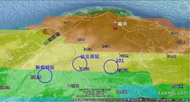
A map shows the epicenter, top, in red, of the magnitude 4 earthquake that hit Taipei’s Shilin District at 12:31am yesterday.

Photo courtesy of National Taiwan University professor Chen Hung-yu

.....
February 12 2014 05:39 PMEarthquakeTaiwanShilin District, [Tatun Volcano Group]Damage levelDetails
.....
Earthquake in Taiwan on Wednesday, 12 February, 2014 at 17:39 (05:39 PM) UTC.
Description
Northern Taiwan was rocked by a magnitude 4 earthquake at 12:31am yesterday, renewing concerns about the potential for volcanoes in the Tatun Volcano Group in Yangmingshan National Park to erupt. At press time, no casualties had been reported from the quake and only minor damage - to the Pingdeng Elementary School on Yangmingshan �" was reported. Many residents in the area were startled by the quake, which caused a loud rumbling sound. Central Weather Bureau data showed that the epicenter of the quake was in Taipei's Shilin District , 11.8km north of Taipei City Hall at a depth of 6.3km. The strongest intensity of the quake, Level 4, was detected on Yangmingshan, followed by Level 3 in Wugu in New Taipei City and Taoyuan City, and Level 2 in Taipei and Keelung. The bureau's records show that 19 earthquakes with a magnitude exceeding 3 have occurred within a 5km radius of the epicenter of yesterday's quake since 1980. The largest one was in 1988, with a magnitude of 5.3. Yesterday's quake was the strongest within the perimeter of the Tatun group in 26 years, the bureau said. Seismology Center Director Kuo Kai-wen said the earthquake was a stress adjustment that occurs after lava cools down. "When the lava in a volcano cools down, it shrinks in size. This will subsequently lead to gaps in the rock layers. Pulled by gravity, the rock layer on top falls. This kind of stress adjustment is quite normal," he said. Yesterday's quake was not caused by the active fault at the foot of Yangminshan, as its epicenter and the fault are about 6km apart, Kuo said. Nevertheless, the earthquake generated concern that one or more of the Tatun volcanoes might erupt soon. Kuo said that was an unlikely scenario. "The volcanoes in Tatun are generally considered dormant. Currently, only three to five small earthquakes happen in the area per day. On average, the volcanoes could erupt if there are more than 100 to 200 earthquakes per day, and they have to escalate from deep earthquakes to shallow earthquakes," he said. However, National Taiwan University professor Chen Hongey said the government needs to carefully examine the correlations between yesterday's magnitude 4 earthquake and the active fault, adding that it was quite unusual for an earthquake to occur at the volcanic zone.
.....

Event Time

  1. 2014-02-11 16:31:03 UTC
  2. 2014-02-12 00:31:03 UTC+08:00 at epicenter
  3. 2014-02-11 10:31:03 UTC-06:00 system time

Location

25.105°N 121.434°E depth=14.0km (8.7mi)

Nearby Cities

  1. 10km (6mi) NNW of Banqiao, Taiwan
  2. 11km (7mi) WNW of Taipei, Taiwan
  3. 18km (11mi) NE of Taoyuan City, Taiwan
  4. 28km (17mi) NNE of Daxi, Taiwan
  5. 804km (500mi) ENE of Hong Kong, Hong Kong
.....

Tectonic Summary

Seismotectonics of the Philippine Sea and Vicinity

The Philippine Sea plate is bordered by the larger Pacific and Eurasia plates and the smaller Sunda plate. The Philippine Sea plate is unusual in that its borders are nearly all zones of plate convergence. The Pacific plate is subducted into the mantle, south of Japan, beneath the Izu-Bonin and Mariana island arcs, which extend more than 3,000 km along the eastern margin of the Philippine Sea plate. This subduction zone is characterized by rapid plate convergence and high-level seismicity extending to depths of over 600 km. In spite of this extensive zone of plate convergence, the plate interface has been associated with few great (M>8.0) ‘megathrust’ earthquakes. This low seismic energy release is thought to result from weak coupling along the plate interface (Scholz and Campos, 1995). These convergent plate margins are also associated with unusual zones of back-arc extension (along with resulting seismic activity) that decouple the volcanic island arcs from the remainder of the Philippine Sea Plate (Karig et al., 1978; Klaus et al., 1992).
South of the Mariana arc, the Pacific plate is subducted beneath the Yap Islands along the Yap trench. The long zone of Pacific plate subduction at the eastern margin of the Philippine Sea Plate is responsible for the generation of the deep Izu-Bonin, Mariana, and Yap trenches as well as parallel chains of islands and volcanoes, typical of circum-pacific island arcs. Similarly, the northwestern margin of the Philippine Sea plate is subducting beneath the Eurasia plate along a convergent zone, extending from southern Honshu to the northeastern coast of Taiwan, manifested by the Ryukyu Islands and the Nansei-Shoto (Ryukyu) trench. The Ryukyu Subduction Zone is associated with a similar zone of back-arc extension, the Okinawa Trough. At Taiwan, the plate boundary is characterized by a zone of arc-continent collision, whereby the northern end of the Luzon island arc is colliding with the buoyant crust of the Eurasia continental margin offshore China.
Along its western margin, the Philippine Sea plate is associated with a zone of oblique convergence with the Sunda Plate. This highly active convergent plate boundary extends along both sides the Philippine Islands, from Luzon in the north to the Celebes Islands in the south. The tectonic setting of the Philippines is unusual in several respects: it is characterized by opposite-facing subduction systems on its east and west sides; the archipelago is cut by a major transform fault, the Philippine Fault; and the arc complex itself is marked by active volcanism, faulting, and high seismic activity. Subduction of the Philippine Sea Plate occurs at the eastern margin of the archipelago along the Philippine Trench and its northern extension, the East Luzon Trough. The East Luzon Trough is thought to be an unusual example of a subduction zone in the process of formation, as the Philippine Trench system gradually extends northward (Hamburger et al., 1983). On the west side of Luzon, the Sunda Plate subducts eastward along a series of trenches, including the Manila Trench in the north, the smaller less well-developed Negros Trench in the central Philippines, and the Sulu and Cotabato trenches in the south (Cardwell et al., 1980). At its northern and southern terminations, subduction at the Manila Trench is interrupted by arc-continent collision, between the northern Philippine arc and the Eurasian continental margin at Taiwan and between the Sulu-Borneo Block and Luzon at the island of Mindoro. The Philippine fault, which extends over 1,200 km within the Philippine arc, is seismically active. The fault has been associated with major historical earthquakes, including the destructive M7.6 Luzon earthquake of 1990 (Yoshida and Abe, 1992). A number of other active intra-arc fault systems are associated with high seismic activity, including the Cotabato Fault and the Verde Passage-Sibuyan Sea Fault (Galgana et al., 2007).
Relative plate motion vectors near the Philippines (about 80 mm/yr) is oblique to the plate boundary along the two plate margins of central Luzon, where it is partitioned into orthogonal plate convergence along the trenches and nearly pure translational motion along the Philippine Fault (Barrier et al., 1991). Profiles B and C reveal evidence of opposing inclined seismic zones at intermediate depths (roughly 70-300 km) and complex tectonics at the surface along the Philippine Fault.
Several relevant tectonic elements, plate boundaries and active volcanoes, provide a context for the seismicity presented on the main map. The plate boundaries are most accurate along the axis of the trenches and more diffuse or speculative in the South China Sea and Lesser Sunda Islands. The active volcanic arcs (Siebert and Simkin, 2002) follow the Izu, Volcano, Mariana, and Ryukyu island chains and the main Philippine islands parallel to the Manila, Negros, Cotabato, and Philippine trenches.
Seismic activity along the boundaries of the Philippine Sea Plate (Allen et al., 2009) has produced 7 great (M>8.0) earthquakes and 250 large (M>7) events. Among the most destructive events were the 1923 Kanto, the 1948 Fukui and the 1995 Kobe (Japan) earthquakes (99,000, 5,100, and 6,400 casualties, respectively), the 1935 and the 1999 Chi-Chi (Taiwan) earthquakes (3,300 and 2,500 casualties, respectively), and the 1976 M7.6 Moro Gulf and 1990 M7.6 Luzon (Philippines) earthquakes (7,100 and 2,400 casualties, respectively). There have also been a number of tsunami-generating events in the region, including the Moro Gulf earthquake, whose tsunami resulted in more than 5000 deaths.
More information on regional seismicity and tectonics
.....

Shilin earthquake renews concern about volcanoes

YANGMINGSHAN PARK:The Central Weather Bureau said the 12:31am quake was the largest one within the perimeters of the Tatun Volcano Group in 26 years

By Shelley Shan  /  Staff reporter

A map shows the epicenter, top, in red, of the magnitude 4 earthquake that hit Taipei’s Shilin District at 12:31am yesterday.

Photo courtesy of National Taiwan University professor Chen Hung-yu

Northern Taiwan was rocked by a magnitude 4 earthquake at 12:31am yesterday, renewing concerns about the potential for volcanoes in the Tatun Volcano Group (大屯火山群) in Yangmingshan National Park to erupt.
At press time, no casualties had been reported from the quake and only minor damage — to the Pingdeng Elementary School on Yangmingshan — was reported.
Many residents in the area were startled by the quake, which caused a loud rumbling sound.
Central Weather Bureau data showed that the epicenter of the quake was in Taipei’s Shilin District (士林), 11.8km north of Taipei City Hall at a depth of 6.3km.
The strongest intensity of the quake, Level 4, was detected on Yangmingshan, followed by Level 3 in Wugu (五股) in New Taipei City (新北市) and Taoyuan City, and Level 2 in Taipei and Keelung.
The bureau’s records show that 19 earthquakes with a magnitude exceeding 3 have occurred within a 5km radius of the epicenter of yesterday’s quake since 1980. The largest one was in 1988, with a magnitude of 5.3.


Read More Here
.....
Enhanced by Zemanta

Wednesday, January 1, 2014

Taiwanese authorities are monitoring hundreds of people who may have had contact with a mainland Chinese tourist infected with the H7N9 strain of bird flu, officials said Wednesday.

EPIDEMICS

Hundreds monitored in Taiwan after bird flu case


by Staff Writers Taipei (AFP) Jan 01, 2014


Taiwanese authorities are monitoring hundreds of people who may have had contact with a mainland Chinese tourist infected with the H7N9 strain of bird flu, officials said Wednesday.
The 86-year-old man from the eastern Chinese province of Jiangsu is in stable condition in hospital in Taiwan, where he was on an eight-day tour, the Centers for Disease Control (CDC) said in a statement.
As many as 500 people may have had contact with him, all of whom are being asked to report to doctors should they develop possible symptoms, the statement added.
The 149 people who may have had close contact include two family members accompanying him on the tour, the tour guide, bus driver, medical personnel and patients sharing the same hospital ward, it said.
"Three medical personnel have shown symptoms of upper respiratory tract infections and taken medicines as preventative treatment," the statement said, adding that they should monitor their condition for two weeks while awaiting the outcome of tests.
They have not been placed in quarantine.

Read More Here

Enhanced by Zemanta

Friday, November 1, 2013

Taiwan - 3 Earthquakes Ranging in Mangitude from 6.3 to 4.5 in the last 5 days


Earth Watch Report -  Earthquakes


Taiwan  -  6.3mag EQ  October  31st  2013 photo Taiwan-63MagEQOctober31st2013_zpsc254a131.jpg

..........

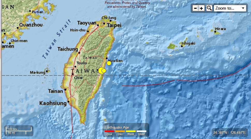
M 6.3 - 45km SSW of Hualian, Taiwan

2013-10-31 12:02:09 UTC

Earthquake location 23.591°N, 121.443°E

Event Time

  1. 2013-10-31 12:02:09 UTC
  2. 2013-10-31 20:02:09 UTC+08:00 at epicenter
  3. 2013-10-31 07:02:09 UTC-05:00 system time

Location

23.591°N 121.443°E depth=12.0km (7.5mi)

Nearby Cities

  1. 45km (28mi) SSW of Hualian, Taiwan
  2. 63km (39mi) SE of Buli, Taiwan
  3. 72km (45mi) ESE of Lugu, Taiwan
  4. 87km (54mi) ESE of Nantou, Taiwan
  5. 761km (473mi) ENE of Hong Kong, Hong Kong
.....

Instrumental Intensity

ShakeMap Intensity Image
.....
Taiwan  -  6.3 Mag EQ  October 31st  2013 photo Taiwan-63MagEQOctober31st2013_zps1ab19726.jpg
.....

Tectonic Summary

The October 31, 2013 M 6.3 earthquake southwest of Hualian, Taiwan occurred as the result of shallow oblique-thrust faulting near the central-east coast of the island of Taiwan and the boundary between the Philippine Sea and Eurasia plates. East of the October 31 earthquake, plate boundary tectonics are dominated by the westward subduction of the Philippine Sea Plate beneath Eurasia along the Ryukyu Trench, which runs from southwest Japan to Taiwan. Some authors infer that this subduction continues beneath the east coast of Taiwan. South of the island towards the Philippines, the plate boundary reflects arc-continent collision more than traditional subduction. The October 31 earthquake occurred at the transition between these tectonic regimes, and is a consequence of the convergence between these major plates. At the location of this earthquake, the Philippine Sea plate moves to the northwest with respect to Eurasia at a velocity of approximately 77 mm/yr.
This region of Taiwan is familiar with moderate to large earthquake activity, and has hosted over 60 events of M6 or greater within 250 km of the October 31 event in the past 40 years. Seven of these were M7 or greater, including a M7.4 earthquake 40 km to the north of the October 31 event in November 1986, which caused 13 fatalities.

Seismotectonics of the Philippine Sea and Vicinity

The Philippine Sea plate is bordered by the larger Pacific and Eurasia plates and the smaller Sunda plate. The Philippine Sea plate is unusual in that its borders are nearly all zones of plate convergence. The Pacific plate is subducted into the mantle, south of Japan, beneath the Izu-Bonin and Mariana island arcs, which extend more than 3,000 km along the eastern margin of the Philippine Sea plate. This subduction zone is characterized by rapid plate convergence and high-level seismicity extending to depths of over 600 km. In spite of this extensive zone of plate convergence, the plate interface has been associated with few great (M>8.0) ‘megathrust’ earthquakes. This low seismic energy release is thought to result from weak coupling along the plate interface (Scholz and Campos, 1995). These convergent plate margins are also associated with unusual zones of back-arc extension (along with resulting seismic activity) that decouple the volcanic island arcs from the remainder of the Philippine Sea Plate (Karig et al., 1978; Klaus et al., 1992).
South of the Mariana arc, the Pacific plate is subducted beneath the Yap Islands along the Yap trench. The long zone of Pacific plate subduction at the eastern margin of the Philippine Sea Plate is responsible for the generation of the deep Izu-Bonin, Mariana, and Yap trenches as well as parallel chains of islands and volcanoes, typical of circum-pacific island arcs. Similarly, the northwestern margin of the Philippine Sea plate is subducting beneath the Eurasia plate along a convergent zone, extending from southern Honshu to the northeastern coast of Taiwan, manifested by the Ryukyu Islands and the Nansei-Shoto (Ryukyu) trench. The Ryukyu Subduction Zone is associated with a similar zone of back-arc extension, the Okinawa Trough. At Taiwan, the plate boundary is characterized by a zone of arc-continent collision, whereby the northern end of the Luzon island arc is colliding with the buoyant crust of the Eurasia continental margin offshore China.
Along its western margin, the Philippine Sea plate is associated with a zone of oblique convergence with the Sunda Plate. This highly active convergent plate boundary extends along both sides the Philippine Islands, from Luzon in the north to the Celebes Islands in the south. The tectonic setting of the Philippines is unusual in several respects: it is characterized by opposite-facing subduction systems on its east and west sides; the archipelago is cut by a major transform fault, the Philippine Fault; and the arc complex itself is marked by active volcanism, faulting, and high seismic activity. Subduction of the Philippine Sea Plate occurs at the eastern margin of the archipelago along the Philippine Trench and its northern extension, the East Luzon Trough. The East Luzon Trough is thought to be an unusual example of a subduction zone in the process of formation, as the Philippine Trench system gradually extends northward (Hamburger et al., 1983). On the west side of Luzon, the Sunda Plate subducts eastward along a series of trenches, including the Manila Trench in the north, the smaller less well-developed Negros Trench in the central Philippines, and the Sulu and Cotabato trenches in the south (Cardwell et al., 1980). At its northern and southern terminations, subduction at the Manila Trench is interrupted by arc-continent collision, between the northern Philippine arc and the Eurasian continental margin at Taiwan and between the Sulu-Borneo Block and Luzon at the island of Mindoro. The Philippine fault, which extends over 1,200 km within the Philippine arc, is seismically active. The fault has been associated with major historical earthquakes, including the destructive M7.6 Luzon earthquake of 1990 (Yoshida and Abe, 1992). A number of other active intra-arc fault systems are associated with high seismic activity, including the Cotabato Fault and the Verde Passage-Sibuyan Sea Fault (Galgana et al., 2007).
Relative plate motion vectors near the Philippines (about 80 mm/yr) is oblique to the plate boundary along the two plate margins of central Luzon, where it is partitioned into orthogonal plate convergence along the trenches and nearly pure translational motion along the Philippine Fault (Barrier et al., 1991). Profiles B and C reveal evidence of opposing inclined seismic zones at intermediate depths (roughly 70-300 km) and complex tectonics at the surface along the Philippine Fault.
Several relevant tectonic elements, plate boundaries and active volcanoes, provide a context for the seismicity presented on the main map. The plate boundaries are most accurate along the axis of the trenches and more diffuse or speculative in the South China Sea and Lesser Sunda Islands. The active volcanic arcs (Siebert and Simkin, 2002) follow the Izu, Volcano, Mariana, and Ryukyu island chains and the main Philippine islands parallel to the Manila, Negros, Cotabato, and Philippine trenches.
Seismic activity along the boundaries of the Philippine Sea Plate (Allen et al., 2009) has produced 7 great (M>8.0) earthquakes and 250 large (M>7) events. Among the most destructive events were the 1923 Kanto, the 1948 Fukui and the 1995 Kobe (Japan) earthquakes (99,000, 5,100, and 6,400 casualties, respectively), the 1935 and the 1999 Chi-Chi (Taiwan) earthquakes (3,300 and 2,500 casualties, respectively), and the 1976 M7.6 Moro Gulf and 1990 M7.6 Luzon (Philippines) earthquakes (7,100 and 2,400 casualties, respectively). There have also been a number of tsunami-generating events in the region, including the Moro Gulf earthquake, whose tsunami resulted in more than 5000 deaths.

More information on regional seismicity and tectonics
.....

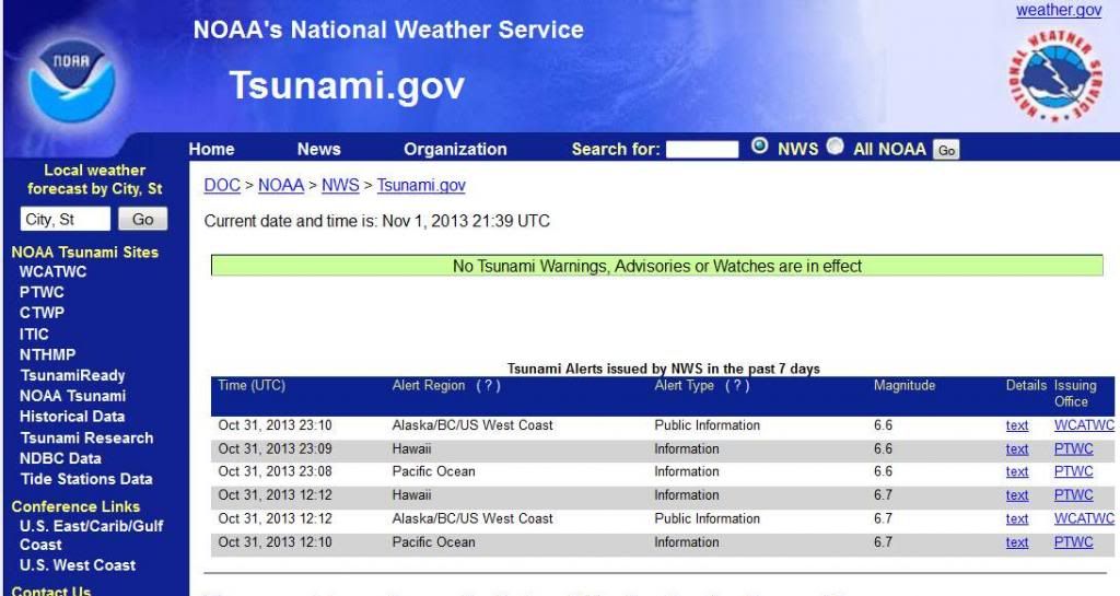
6.6 quake hits Taiwan; no tsunami warning to US coast

6.6 quake hits Taiwan; no tsunami warning to US coast

by Associated Press
Posted on October 31, 2013 at 6:06 AM

TAIPEI, Taiwan (AP) -- A strong earthquake hit eastern Taiwan on Thursday, shaking buildings over a wide area including the capital. There were no immediate reports of serious damage or casualties.
The U.S. Geological Survey said the earthquake measured magnitude 6.6 and struck in the evening. It was centered in a remote mountainous area 45 kilometers (28 miles) south-southwest of the coastal city of Hualian at a depth of just 9.3 kilometers (5.8 miles), it said.
In Taipei, the capital, buildings swayed for more than 10 seconds and startled residents ducked for cover.


Read More Here
.....
Enhanced by Zemanta

Thursday, August 15, 2013

Just when you thought Fukushima was the only game in the nuclear nightmare the truth about Taiwan enters the Arena


Reporters inspect an observation well which is dug to take underground water samples near Fukushima Dai-ichi nuclear plant Unit 1 of Tokyo Electric Power Co., in Okuma, Fukushima prefecture, northeastern Japan.
Kyodo News/AP/File


More Bad News for the Pacific - Taiwanese NPP Leaking Radioactive Water

By John Daly | Tue, 13 August 2013 00:01

Water is an essential ingredient for the operation of most nuclear power plants, from providing the liquid that is flashed to steam to drive turbines to providing coolant for storage of spent fuel. In most NPPs, water is drawn from nearby rivers or from the ocean.
Unfortunately, that reliance can also prove to be a liability.
In reviewing the 11 March 2011 catastrophe that overwhelmed Tokyo Electric Power Co.’s six reactor Fukushima Daiichi NPP, few people remember that it was not the Richter 9.0 earthquake, the fifth largest in modern history, that devastated the facility, but the massive tsunami subsequently generated by the undersea tremor.
Which incidentally killed 25,000 people.
Fukushima Daiichi NPP’s seawall was not high enough to stop the tsunami, which destroyed the facility’s backup diesel generators and fuel tanks upon which keeping the nuclear fuel cool now depended, as the earthquake had severed the facility’s connections to the national electric grid. Nine tsunami generated waves battered the shore.

Related article: The Key to Advancing Nuclear Energy

Two years on, the crippled NPP has yet to be stabilized and its radioactive contents are being spread by – water. On 22 July TEPCO spokesman Masayuki Ono told a regular news conference that plant officials believed that radioactive water that leaked from the wrecked reactors probably seeped into the underground water system and accordingly was likely leaking contaminated water into the sea, acknowledging for the first time a problem long suspected by experts.
How much?
The Japanese government’s Agency for Natural Resources and Energy estimates that 400 tons of groundwater contaminated with radioactive materials are now leaking into the ocean daily from the crippled plant. The Japanese government is now sufficiently alarmed that on 7 August Prime Minister Shinzo Abe told a meeting of the Nuclear Emergency Response Headquarters, "The problem of contaminated water is the most pressing. Rather than leave it up to TEPCO, the central government will come up with the measures to deal with it. The industry minister will instruct TEPCO in order to implement swift and multilayered measures."
Moving southwards, Taiwan’s First Nuclear Power Plant on the island’s northern coast, operating since 1979, has spent fuel rod storage pools that have leaked since December 2009.
How much?
According to the Taiwanese government’s watchdog, Control Yuan, the pools of the two reactors leaked 15,370 milliliters and 4,830 milliliters respectively, with the water containing radioactive materials including Caesium-137, Cobalt-60, Manganese-54, and Chromium-51. The most ominous aspect of the report notes that the NPP operator Taiwan Power Co had failed to find the causes and the leaks continue.


Read More  Here
Enhanced by Zemanta

Monday, July 15, 2013

Tropical Storm - China, MultiProvinces, [Provinces of Zhejiang and Fujian ] : Eastern China on Sunday braced for torrential downpours from Typhoon Soulik

Earth Watch Report  -  Storms

frontier soldier helps a man move away from  fast  moving  waters
....
 TodayTropical StormChinaMultiProvinces, [Provinces of Zhejiang and Fujian ]Damage level Details
....

Tropical Storm in China on Monday, 15 July, 2013 at 03:02 (03:02 AM) UTC.

Description
Eastern China on Sunday braced for torrential downpours from Typhoon Soulik which forced the evacuation of about 500,000 people after killing two people in Taiwan. Soulik lashed coastal Fujian province with winds of 118 kph when it made landfall but weakened to a tropical depression as it moved inland, the China Meteorological Administration said. More than 500,000 people were evacuated from Fujian and neighboring Zhejiang province as the typhoon approached, with 5,500 soldiers deployed to carry out relief work if needed.
....

The Standard

Killer Soulik smashes into east

Monday, July 15, 2013
Eastern China braced itself for torrential downpours from Typhoon Soulik, which forced the evacuation of half a million people after killing two in Taiwan.
Soulik lashed coastal Fujian province with winds of 118 kilometers per hour when it made landfall but had weakened to a tropical depression as it moved inland, the China Meteorological Administration said.
More than half a million people were evacuated from Fujian and neighboring Zhejiang as the typhoon approached, with 5,500 soldiers deployed to carry out relief work if needed. Xinhua News Agency said almost 31,000 ships were called back to port and 20 flights canceled.
Soulik brought a torrential downpour to Xiamen, with 24 centimeters of rain falling on the port city from Saturday to yesterday. Rivers swelled beyond warning levels in some areas, and waves up to 10 meters high pounded sea defenses in Ningde city.
In Taiwan, two people were killed, one was missing and 104 were injured by the storm, with one town reporting widespread landslides and floodwaters a story high.
The northern village of Bailan saw the heaviest rain, with 90 centimeters falling in 48 hours, with winds gusting up to 220km/h.
While Soulik wrought havoc in Taiwan, tearing roofs from homes and causing landslides that blocked roads, eastern China escaped its full force.
"Billboards have been shattered and trees have been uprooted" but no deaths or injuries were reported, Xinhua said.


Read More Here
....
Enhanced by Zemanta