Universe Today

This
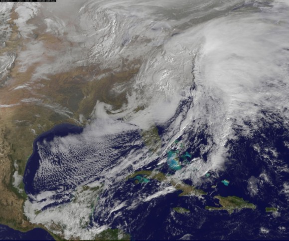
visible image of the winter storm over the U.S. south and East Coast
was taken by NOAA’s GOES-13 satellite on Feb. 13 at 1455 UTC/9:45 a.m.
EST. Snow covered ground can be seen over the Great Lakes region and
Ohio Valley. Image Credit: NASA/NOAA GOES Project
This afternoon, NASA and NOAA published a new image taken by a GOES satellite that showed the extent of the clouds associated with the massive winter storm over the US East Coast – see above and below.
Blizzard, white out and slippery conditions have already caused more than 18 deaths.
The killer storm has brought relentless waves of snow, sleet and ice over the past two days covering a vast swath stretching from inland to coastal areas as it moved up from the southern to northern states.
More than a foot of snow has already fallen in many areas today stretching from the Mid-Atlantic into the entire Northeast region.
Several states have declared states of emergency.
This is the season’s 12th snow storm. In many Northeast localities, the accumulated snowfall totals are three times the normal average. As a result many municipalities are running out of road salt.
And to add insult to injury, much more icy snow is falling overnight into Friday on top of the massive existing mounds and piles of frozen ice and snow that’s accumulated over the past few weeks of subfreezing temperatures.
There are also predictions for patches of “thunder snow” — which is a snow storm mixed with thunder and lightning!
Read More Here


No comments:
Post a Comment
Hello and thank you for visiting my blog. Please share your thoughts and leave a comment :)