Showing posts with label India. Show all posts

Friday, December 11, 2015

HAZMAT - India, [Shree Ganesh Remedies Company] Ankleshwar, State of Gujarat : Toxic Gas Leak


..........
...........
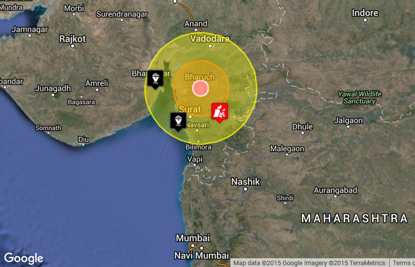
 photo HAZMAT in India on December 11 2015 04.24 AM UTC_zpsoyubmown.png
HAZMAT in India on December 11 2015 04.24 AM UTC
..........

Base data

EDIS NumberHZ-20151211-51206-IND
Event typeHAZMAT
Date/TimeDecember 11 2015 04:24 AM (UTC)
Last updateDecember 11 2015 04:25 AM (UTC)
Cause of event 
Damage levelMedium Damage level

Geographic information

ContinentAsia
CountryIndia
County / StateState of Gujarat
AreaShree Ganesh Remedies Company
SettlementAnkleshwar
Coordinate21° 37.585,73° 0.912

Number of affected people / Humanities loss

Dead person(s)3
Injured person(s)2
............
Three workers of a chemical manufacturing company were killed on the spot and two others are reported critical after inhaling a poisonous gas in a factory premises in the industrial area of Ankleshwar town Thursday morning, police said. The gas leakage occurred in a scrubber tank (storage tank) of Shree Ganesh Remedies Company, which produces pharmaceutical ingredients and pigments, at Ankleshwar GIDC on Thursday morning. The Gujarat Pollution Control Board (GPCB) officials rushed to the spot after learning about the incident and have started probe. Five labourers were working near the scrubber tank containing sodium bromide and hydro chloric acid gas, meant to carry out chemical tests. The accident occurred when the labourers were changing the bottom pipes in the tank. They inhaled the toxic gas emanated from the tanker's chamber and became unconscious. sources said. The incident came into light when the night shift in-charge, made a routine check-up of the plant. On finding five labourers lying down and the gas leak, he immediately stopped the process going on in the chamber and also alerted the factory owner C M Kothiya, who is also vice-president of Ankleshwar Industrial Association. All the affected labourers were immediately rushed to A K Patel Hospital in Ankleshwar. While three of the labourers were declared brought dead by the doctors, the condition of two others are reported to be critical. The deceased have been identified as Raja Yadav (26), Satyendra Yadav (22), Raju Prajapati (24), all residents of Ankleshwar, while two others under critical situation are identified as Kiran Chuahan and Suresh Maurya. The GPCB officials, along with District Industrial Safety and Health officials, and police reached the spot after learning about the incident and started probe into it. The GPCB officials also collected samples from the scrubber tank for lab test. "We have lodged a complaint in this regard and started investigation as to how the gas leaked. We have also informed government officials concerned about the incident," said Inspector P L Chaudhari. GPCB regional officer A V Shah said, "At present it is difficult to say anything, but we suspect that due to the leakage of sodium bromide gas and hydrochloric acid gas, the casualties had taken place. We have started probe to find out more into the incident. Production in the factory has been stopped." This is the second such incident in this industrial hub in the recent past. On Monday, two workers had died while handling chemical waste at the premises of a company.
............

The Indian Express

Gujarat: Gas leak kills 3 workers at Ankleshwar pharmaceutical factory, two critical

Five labourers were working near the scrubber tank containing sodium bromide and hydro chloric acid gas, meant to carry out chemical tests.

By: Express News Service | Surat | Published:December 11, 2015 3:46 am
 
Three workers of a chemical manufacturing company were killed on the spot and two others are reported critical after inhaling a poisonous gas in a factory premises in the industrial area of Ankleshwar town Thursday morning, police said.
The gas leakage occurred in a scrubber tank (storage tank) of Shree Ganesh Remedies Company, which produces pharmaceutical ingredients and pigments, at Ankleshwar GIDC on Thursday morning. The Gujarat Pollution Control Board (GPCB) officials rushed to the spot after learning about the incident and have started probe.
Five labourers were working near the scrubber tank containing sodium bromide and hydro chloric acid gas, meant to carry out chemical tests. The accident occurred when the labourers were changing the bottom pipes in the tank. They inhaled the toxic gas emanated from the tanker’s chamber and became unconscious. sources said.


..........


Monday, December 7, 2015

New Delhi: Several tourists on had a narrow escape when a part of a mountain near Chandigarh-Manali highway collapsed.


Watch: Tourists defy death at Manali-Chandigarh highway

Last Updated: Monday, December 7, 2015 - 15:50
Watch: Tourists defy death at Manali-Chandigarh highway
Zee Media Bureau
New Delhi: Several tourists on had a narrow escape when a part of a mountain near Chandigarh-Manali highway collapsed. The 31-second video, recorded by a mobile phone camera, shows tourists running for their lives. Initially, it was said that the landslide was caused due to an earthquake today in the region, but later it was clarified that the incident has no connection with the earthquake.
  Read More Here

Monday, November 9, 2015

Earthquake Magnitude6.4 - Nicobar Islands, India Region. With a total of 19 earthquakes ranging in magnitude from 4.6 to 6.4 11/08 - 09/2015


..........
 
Globe with Earthquake Location

M6.4 - NICOBAR ISLANDS, INDIA REGION

Preliminary Earthquake Report
Magnitude6.4
Date-Time
  • 8 Nov 2015 16:47:01 UTC
  • 8 Nov 2015 22:47:02 near epicenter
  • 8 Nov 2015 10:47:01 standard time in your timezone
Location6.838N 94.724E
Depth7 km
Distances
  • 123 km (76 mi) NNW of Sabang, Indonesia
  • 156 km (96 mi) NNW of Banda Aceh, Indonesia
  • 211 km (130 mi) NW of Sigli, Indonesia
  • 248 km (153 mi) NW of Reuleuet, Indonesia
  • 873 km (541 mi) WNW of Kuala Lumpur, Malaysia
Location UncertaintyHorizontal: 6.1 km; Vertical 3.1 km
ParametersNph = 121; Dmin = 303.7 km; Rmss = 1.79 seconds; Gp = 33°
Version =
Event IDus 10003vry
For updates, maps, and technical information, see: Event Page or USGS Earthquake Hazards Program
  
..........

Map showing extent (w,s,e,n) = (89.6609, 1.8456000000000001, 99.6609, 11.845600000000001)
6.846°N 94.661°E depth=10.0 km (6.2 mi)View interactive map


19 earthquakes in map area

  1. 4.9 92km NW of Sabang, Indonesia 2015-11-09 07:13:30 UTC 35.0 km
  2. 5.3 77km NNW of Sabang, Indonesia 2015-11-09 06:12:18 UTC 43.5 km
  3. 4.9 150km NW of Sabang, Indonesia 2015-11-08 20:59:39 UTC 10.0 km
  4. 4.7 154km NNW of Sabang, Indonesia 2015-11-08 20:30:06 UTC 10.0 km
  5. 5.0 149km NW of Sabang, Indonesia 2015-11-08 19:14:46 UTC 10.0 km
  6. 4.6 143km NW of Sabang, Indonesia 2015-11-08 18:48:44 UTC 10.0 km
  7. 4.7 110km NNW of Sabang, Indonesia 2015-11-08 17:46:51 UTC 10.0 km
  8. 5.2 127km NNW of Sabang, Indonesia 2015-11-08 16:59:20 UTC 10.0 km
  9. M 6.4 - 128km NW of Sabang, Indonesia 2015-11-08 16:47:02 UTC 10.0 km

  10. 4.9 144km NW of Sabang, Indonesia 2015-11-08 16:42:38 UTC 10.0 km
  11. 4.8 139km NNW of Sabang, Indonesia 2015-11-08 15:49:47 UTC 15.7 km
  12. 4.9 143km NW of Sabang, Indonesia 2015-11-08 14:47:01 UTC 10.0 km
  13. 5.1 130km NW of Sabang, Indonesia 2015-11-08 14:34:05 UTC 10.0 km
  14. 4.7 149km NNW of Sabang, Indonesia 2015-11-08 13:38:38 UTC 7.4 km
  15. 5.2 135km NW of Sabang, Indonesia 2015-11-08 13:23:48 UTC 13.5 km
  16. 5.1 125km NW of Sabang, Indonesia 2015-11-08 11:54:42 UTC 32.2 km
  17. 4.9 137km NNW of Sabang, Indonesia 2015-11-08 10:53:35 UTC 53.8 km
  18. 5.2 138km NW of Sabang, Indonesia 2015-11-08 10:42:04 UTC 27.1 km
  19. 4.8 147km NW of Sabang, Indonesia 2015-11-08 10:04:36 UTC 18.0 km
 
..........
..........


Saturday, October 24, 2015

Unseasonal Snowfall Brings Winter in October in Parts of Kashmir


Unseasonal Snowfall Brings Winter in October in Parts of Kashmir


Unseasonal Snowfall Brings Winter in October in Parts of Kashmir
Met department officials say they have no record of heavy snowfall in the Valley during the month of October
Srinagar:  Even though it's the middle of autumn, in parts of Kashmir it seems like winter. Cold temperatures have brought unseasonal snowfall at higher reaches of the valley.

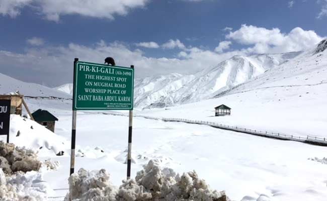
For last two days Mughal Road that connects Kashmir valley with Pirpanjal region has remained closed and hundreds of trucks were stranded along the key passage.

At an altitude of 11,000 feet, Peer Ki Gali, the highest spot on Mughal Road has seen about two feet of snowfall in last 48 hours. But as the weather improved today and sun came out, officials increased their efforts to clear the road.

 
"Snow clearance machines are at work since yesterday and road will be fully functional today. We have already cleared over 500 trucks yesterday evening," said Nisar Ahmad, an engineer at Mughal Road.


Read More Here

Wednesday, May 7, 2014

Biological Hazard - India, State of Madhya Pradesh, Meghnagar

Earth Watch Report  -  Biological Hazards


.....
Biological HazardIndiaState of Madhya Pradesh, MeghnagarDamage levelDetails

.....

RSOE EDIS

Description
The contagious disease measles, popularly known as 'Chhoti Mata’ is spreading in the villages, which fall under the CHC (Community Health Centre) of village Madrani. Till now, the disease has claimed lives of two children in village Dhebar and of one infant girl in Vasunia Sat Falia of Madrani. After the death of two children, the health department held a check-up camp and found 29 children affected by this disease. However, as per unofficial guess, the number of affected children may be more than double of this number. As an instance, Rajia Bhuria of village Kelkua his two sons and one daughter are affected by this disease, but he did not contact doctors and went to the 'Badwa’ (traditional faith healer), who tied a sacred thread on the hands of affected children. The tribal still believe in these sorts of faith healers and the treatment of worshipping the Mataji (deity) can heal the suffering children. Because of these superstitions, many of the tribal have not approached to the doctors and therefore, the health department does not know the right number of affected children.Superstitions and inefficient CHC together multiplying the problem Another aspect of this situation is the various drawbacks of this CHC of Madrani. The most important is of insufficient staff provided at this health centre. There is only one doctor and one ANM at this centre, who have the responsibility of more than a dozen villages around this CHC. Moreover, many villagers among the thousands of villagers living in these villages have complaint that, when they come to the CHC, they do not find the doctor or nurse here. In these circumstances, the villagers again get turned towards the 'Badwas or Tantriks’. Many times, when the disease gets cured naturally or due to use of some herbs, their faith in these faith healers become stronger. Because of high influence of such superstitions in these areas, these people do not approach to doctors and the result is evident that even after the death of three children, people are not bringing the affected children to the doctors. During the check-up camp and visits of doctors, many malnourished children were also seen, but the doctors ignored their need for treatment and dietary recommendations or providing them the facilities of government schemes for malnourished children.What doctors said? "Symptoms of measles were found in 29 children, among them 3 died and 24 children have recovered, to whom, the dose of vitamin A were given. Two more children are recovering". Dr. Ajnar, Madrani Community Health Centre "This is a viral disease, which spread in May-June and usually after every four years. The department is trying its best for treatment of affected children, but due to lack of awareness, the villagers are not bringing the children to the hospital".
Biohazard name:Measles (fatal)
Biohazard level:2/4 Medium
Biohazard desc.:Bacteria and viruses that cause only mild disease to humans, or are difficult to contract via aerosol in a lab setting, such as hepatitis A, B, and C, influenza A, Lyme disease, salmonella, mumps, measles, scrapie, dengue fever, and HIV. "Routine diagnostic work with clinical specimens can be done safely at Biosafety Level 2, using Biosafety Level 2 practices and procedures. Research work (including co-cultivation, virus replication studies, or manipulations involving concentrated virus) can be done in a BSL-2 (P2) facility, using BSL-3 practices and procedures. Virus production activities, including virus concentrations, require a BSL-3 (P3) facility and use of BSL-3 practices and procedures", see Recommended Biosafety Levels for Infectious Agents.
Symptoms:
Status:confirmed

......

Measles spreads in villages, 3 die, over 30 affected


fpj-default-image-new2
Meghnagar: The contagious disease measles, popularly known as ‘Chhoti Mata’ is spreading in the villages, which fall under the CHC (Community Health Centre) of village Madrani. Till now, the disease has claimed lives of two children in village Dhebar and of one infant girl in Vasunia Sat Falia of Madrani.
After the death of two children, the health department held a check-up camp and found 29 children affected by this disease. However, as per unofficial guess, the number of affected children may be more than double of this number.
As an instance, Rajia Bhuria of village Kelkua his two sons and one daughter are affected by this disease, but he did not contact doctors and went to the ‘Badwa’ (traditional faith healer), who tied a sacred thread on the hands of affected children. The tribal still believe in these sorts of faith healers and the treatment of worshipping the Mataji (deity) can heal the suffering children.
Because of these superstitions, many of the tribal have not approached to the doctors and therefore, the health department does not know the right number of affected children.Superstitions and inefficient CHC together multiplying the problem Another aspect of this situation is the various drawbacks of this CHC of Madrani.
The most important is of insufficient staff provided at this health centre. There is only one doctor and one ANM at this centre, who have the responsibility of more than a dozen villages around this CHC. Moreover, many villagers among the thousands of villagers living in these villages have complaint that, when they come to the CHC, they do not find the doctor or nurse here.


.....
Enhanced by Zemanta

Friday, November 22, 2013

Biological Hazard - India, State of Tamil Nadu, [Erode region] : Up to 175 head of cattle have died of foot-and- mouth disease (FMD) in Erode district

Earth Watch Report

File:Infrared image of a cow with with foot-and-mouth disease.jpg
Image Source  :  Wikimedia. Org
electronic thermography (thermal recording) image of a cow infected with foot-and-mouth-disease virus. Note that the hooves are red. Red color in the hooves indicates heat.
Author Photo by Craig Packer. http://www.ars.usda.gov/is/graphics/photos/apr09/d1393-1.htm

File:Electronmicrograph of the foot-and-mouth disease virus.png
Image Source  : 
Electronmicrograph of the foot-and-mouth disease virus, a highly virulent pathogen in cattle, pigs, and sheep.
.....

Biological HazardIndiaState of Tamil Nadu, [Erode region]Damage level
 
Details
.....
Description
Up to 175 head of cattle have died of foot-and- mouth disease (FMD) in Erode district in south India's Tamil Nadu state in the last two months, Press Trust of India (PTI) reported. The Animal Husbandary Department said the disease has led to the closure of five cattle shandies (markets) over the past 10 days. To prevent the disease from spreading further, the department has provided preventive vaccinations to some 360,000 cattle in the district. Officials and veterinarians said vaccinations were also given free of charge to cattle owners in all villages.
Biohazard name: Foot-and- mouth disease (FMD)
Biohazard level: 3/4 Hight
Biohazard desc.: Bacteria and viruses that can cause severe to fatal disease in humans, but for which vaccines or other treatments exist, such as anthrax, West Nile virus, Venezuelan equine encephalitis, SARS virus, variola virus (smallpox), tuberculosis, typhus, Rift Valley fever, Rocky Mountain spotted fever, yellow fever, and malaria. Among parasites Plasmodium falciparum, which causes Malaria, and Trypanosoma cruzi, which causes trypanosomiasis, also come under this level.
Symptoms:
Status: confirmed
.....

Foot-and-mouth disease scare hits Aavin procurement

L. Srikrishna
 
Milk procurement dropped from 1.80 lakh litres to 1.75 lakh litres within two days, following the scare. File photo
The Hindu Milk procurement dropped from 1.80 lakh litres to 1.75 lakh litres within two days, following the scare. File photo
There was a marginal dip in milk procurement levels in Madurai Aavin, officials said on Thursday.
Even as rumours of cattle falling prey to foot-and-mouth disease were spreading in Vadakku Navinipatti and a few places surrounding Melur near Madurai, the officials from the Department of Animal Husbandry and a team of experts from the Tamil Nadu Veterinary and Animal Sciences University, Chennai, camped at these villages and interacted with the people.
The officials said they had created awareness among the people of the preventive measures to be taken to save their cattle and instilled confidence in them at this crucial hour.
According to Aavin General Manager Christie, the normal milk procurement level was around 1.75 lakh litres per day during this season. Apart from Madurai, Aavin procured milk from neighbouring Theni district as well, he noted.
The scare of spread of foot-and-mouth disease and the intermittent rains had resulted in a marginal dip in milk procurement. Milk procurement dropped from 1.80 lakh litres to 1.75 lakh litres within two days, another official pointed out.

.....


Enhanced by Zemanta

Monday, October 14, 2013

India cyclone survivors return home to destruction

SHAKE AND BLOW

by Staff Writers Gopalpur, India (AFP) Oct 14, 2013


Mass evacuations in Vietnam for typhoon NariHanoi (AFP) Oct 14, 2013 - Vietnam is evacuating tens of thousands of people in the path of Typhoon Nari, state media said Monday, after the powerful storm left 13 dead in the Philippines. Nari is expected to slam into central Vietnam on Tuesday morning, after ripping off rooftops, toppling trees and triggering flash floods in the northern Philippines over the weekend.
"Very strong winds are expected from later Monday. There might be heavy rains of up to 500 millimetres (20 inches) over the next few days," said Bui Minh Tang, head of Vietnam's national weather forecast centre.
Authorities in the central provinces of Thua Thien Hue and Da Nang were moving roughly 66,000 people in vulnerable coastal area to safety, according to the state-controlled Tuoi Tre newspaper.
Boats have been urged to seek shelter and food has been prepared for residents in case of prolonged flooding, reports said.
Vietnam is hit by around eight to 10 tropical storms every year, often resulting in loss of life and heavy material damage.
Last month Typhoon Wutip left a trail of destruction in the communist state, ripping the roofs off nearly 200,000 houses and leaving several people dead, according to state media.
Forty people have been killed in flooding in Vietnam since early September, according to an official toll.
Mexico issues warning ahead of Tropical Storm OctaveMexico City (AFP) Oct 14, 2013 - The Mexican government issued a tropical storm warning Monday as Octave took aim at an already disaster-weary Mexico, while a second storm, Priscilla, strengthened far out to sea.
Tropical Storm Octave, with winds of up to 60 miles (96 kilometers) per hour, was expected to approach the west coast of Baja California late Monday and Tuesday, US National Hurricane Center said in its latest advisory.
It was forecast to weaken as it moved closer, and Baja California civil protection chief Carlos Miguel Enriquez said it would make landfall "not as a storm, nor depression, just as a remnant."
Still, the storm could dump three to six inches (7.6 to 15.2 centimeters) of rain over much of the southern Baja California peninsula, just three weeks after the country weathered the dual blast of storms Manuel and Ingrid.
At least 157 people were killed in historic downpours, including 101 in the southern Guerrero state. Dozens were left missing in the mountainous village of La Pintada after a landslide buried a third of the community.
September's torrential rains left 1.7 million people homeless.
Authorities have issued a tropical storm warning for the southwestern portion of the Baja California peninsula, and Enriquez said they were considering whether to evacuate some residents.
Meanwhile, Tropical Storm Priscilla strengthened in the eastern Pacific Monday, packing winds of up to 45 miles (72 kilometers) per hour, forecasters from the NHC said.
The weather system was situated some 646 miles (1,040 kilometers) southwest of the southern tip of Baja California.
Although some additional strengthening was expected over the next day or two, no coastal warnings or watches were in effect, the forecasters said.

Hundreds of thousands of people who fled India's strongest cyclone in 14 years returned home to scenes of devastation Monday, as a massive relief operation kicked into gear.
Teams raced to restore power and other services after the cyclone struck India's eastern coast on Saturday, killing at least 22 people and leaving a trail of destruction.
Cyclone Phailin pounded the states of Orissa and Andhra Pradesh further south, bringing winds of more than 200 kilometres an hour (125 miles per hour), uprooting trees, overturning trucks, knocking out power lines and flooding farmland.
"The death toll from the cyclone in Orissa has now gone up from 17 to 21. The deaths are mostly due to falling walls and tree branches," Pradipta Kumar Mohapatra, the state's special relief commissioner, told AFP by phone. One person was also killed in Andhra Pradesh, officials said.
Casualties were minimised after one million people spent the night huddled in shelters, temples and schools during the ferocious storm, in what officials said was India's largest ever evacuation operation.
Indian President Pranab Mukherjee led a chorus of praise for the evacuation effort and the "high level of preparedness", as well as for the accurate forecasting of the country's weather bureaus.
Relief agencies said government officials seemed to have learnt the lessons from 1999, when a cyclone tore through the same region, killing more than 8,000 people and devastating crops and livestock.
"The government and the community were more aware this time and better prepared, it was a collective effort and a successful one," Manish Choudhary, a director of the Indian Red Cross Society, told AFP.
Officials in Orissa said 873,000 people moved before the cyclone made landfall on Saturday evening, while at least another 100,000 were evacuated in Andhra Pradesh. Residents were also evacuated from coastal regions of West Bengal state.
Many returned home on Monday to discover their homes -- often built just of flimsy mud and thatch -- as well as their businesses damaged or destroyed.
Mostly poor farmers and fishermen, they were resigned to getting on with the job of rebuilding rather than waiting for rescue workers.

Read More Here
Enhanced by Zemanta

Sunday, October 13, 2013

one of the largest cyclones in India’s history has reached its eastern coast, prompting a national red alert and sending some 550,000 people to seek shelter


'Red alert': Monster cyclone hits Indian coast, sends 550,000 fleeing


Published time: October 12, 2013 05:34
Edited time: October 13, 2013 00:09

A woman carries her baby as she moves to a safer place with others at the village Donkuru in Srikakulam district in the southern Indian state of Andhra Pradesh October 12, 2013. (Reuters / Adnan Abidi)


As one of the largest cyclones in India’s history has reached its eastern coast, prompting a national red alert and sending some 550,000 people scurrying for shelter, the first deaths have been reported.

Five people were killed in Odisha when trees uprooted by wind gusts fell on them, local media cited police officials as saying. 

Indian residents make their way home through heavy cyclone rain in Berhampur city, about 180 kilometers south from eastern city Bhubaneswar on October 12, 2013. (AFP Photo / Asit Kumar)
Wind speed up to 200 kilometers per hour in gusts, local officials say, according to AFP.
Cyclone Phailin is likely to be the strongest to hit India since 1999, when a deadly Orissa cyclone killed 10,000 people and caused $4.5 billion worth of damage. This cyclone may surpass that one, as it gathers strength over the warm water of the Bay of Bengal on its way toward land. 
Heavy rain and strong winds of up to 220 kilometers per hour were already lashing the country’s eastern coast on Saturday morning as the cyclone approached. Television footage showed gusts of wind snapping branches from trees and residents of coastal villages flocking to shelters.

Hurricane Central         @twc_hurricane
HT @NDTV Over 550,000 evacuated, "many refused to move, had to be convinced" in Odisha and Andhra Pradesh states.


"This is one of the largest evacuations undertaken in India," said Shashidhar Reddy, vice chairman of the National Disaster Management Authority. "We will be on a war footing."
"We've been instructed by the government to use force in case people resist," Pradipta Mohapatra, Orissa  state special relief commissioner, told AFP.
Paradip, a major port in Odisha, Andhra Pradesh, was closed and vessels ordered to sail to the open sea in the wake of the storm. Among them is an oil tanker holding about 2 million barrels of crude.
The US Navy's weather service estimated the wind at sea was gusting at 314 kilometers per hour, with some forecasters comparing the cyclone to Hurricane Katrina, which devastated New Orleans in 2005.

Read More Here

*********************************************************

India cyclone: 12m people face mass disruption as Phailin makes landfall

Severe storm hits Odisha and Andhra Pradesh states on east coast
Link to video: India prepares for cyclone Phailin
Up to 12m people could face mass disruption from cyclone Phailin, which is expected to cause severe damage in eastern India after it made landfall on Saturday afternoon.
Three people have been declared dead and rain and winds of at least 137mph continued to lash the east coast on Saturday while hundreds of thousands of inhabitants fled to higher ground or cyclone shelters. The Indian government issued a red alert and warned that the storm, which fills most of the bay of Bengal, could inflict serious damage when it made landfall.
More than 600,000 people had been moved to safety from India's eastern coastline on Friday as cyclone Phailin was classified as a supercyclone.
Roads were all but empty on Saturday as high waves lashed the coastline of Orissa state, which will bear the brunt of the cyclone. By midafternoon, wind gusts were so strong that they could blow over grown men. Along the coast, seawater was pushing inland, swamping villages where many people survive as subsistence farmers in mud and thatch huts.

Read More Here

**********************************************************
Enhanced by Zemanta

Friday, August 2, 2013

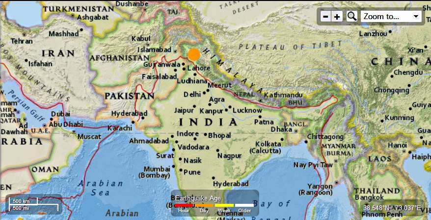
India - 5.4 - 13km SE of Kishtwar

Earth Watch Report  -  Earthquakes

 photo India-54MagEQAugust1st2013_zps500ce01d.jpg
...

M5.4 - 13km SE of Kishtwar, India

 2013-08-02 02:32:48 UTC

Earthquake location 33.233°N, 75.876°E

Event Time

  1. 2013-08-02 02:32:48 UTC
  2. 2013-08-02 08:02:48 UTC+05:30 at epicenter
  3. 2013-08-01 21:32:48 UTC-05:00 system time

Location

33.233°N 75.876°E depth=15.8km (9.8mi)

Nearby Cities

  1. 13km (8mi) SE of Kishtwar, India
  2. 30km (19mi) ENE of Doda, India
  3. 31km (19mi) NNE of Bhadarwah, India
  4. 76km (47mi) ENE of Udhampur, India
  5. 268km (167mi) E of Islamabad, Pakistan
....

Tectonic Summary

Seismotectonics of the Himalaya and Vicinity

Seismicity in the Himalaya dominantly results from the continental collision of the India and Eurasia plates, which are converging at a relative rate of 40-50 mm/yr. Northward underthrusting of India beneath Eurasia generates numerous earthquakes and consequently makes this area one of the most seismically hazardous regions on Earth. The surface expression of the plate boundary is marked by the foothills of the north-south trending Sulaiman Range in the west, the Indo-Burmese Arc in the east and the east-west trending Himalaya Front in the north of India.
The India-Eurasia plate boundary is a diffuse boundary, which in the region near the north of India, lies within the limits of the Indus-Tsangpo (also called the Yarlung-Zangbo) Suture to the north and the Main Frontal Thrust to the south. The Indus-Tsangpo Suture Zone is located roughly 200 km north of the Himalaya Front and is defined by an exposed ophiolite chain along its southern margin. The narrow (<200km) Himalaya Front includes numerous east-west trending, parallel structures. This region has the highest rates of seismicity and largest earthquakes in the Himalaya region, caused mainly by movement on thrust faults. Examples of significant earthquakes, in this densely populated region, caused by reverse slip movement include the 1934 M8.1 Bihar, the 1905 M7.5 Kangra and the 2005 M7.6 Kashmir earthquakes. The latter two resulted in the highest death tolls for Himalaya earthquakes seen to date, together killing over 100,000 people and leaving millions homeless. The largest instrumentally recorded Himalaya earthquake occurred on 15th August 1950 in Assam, eastern India. This M8.6 right-lateral, strike-slip, earthquake was widely felt over a broad area of central Asia, causing extensive damage to villages in the epicentral region.
The Tibetan Plateau is situated north of the Himalaya, stretching approximately 1000km north-south and 2500km east-west, and is geologically and tectonically complex with several sutures which are hundreds of kilometer-long and generally trend east-west. The Tibetan Plateau is cut by a number of large (>1000km) east-west trending, left-lateral, strike-slip faults, including the long Kunlun, Haiyuan, and the Altyn Tagh. Right-lateral, strike-slip faults (comparable in size to the left-lateral faults), in this region include the Karakorum, Red River, and Sagaing. Secondary north-south trending normal faults also cut the Tibetan Plateau. Thrust faults are found towards the north and south of the Tibetan Plateau. Collectively, these faults accommodate crustal shortening associated with the ongoing collision of the India and Eurasia plates, with thrust faults accommodating north south compression, and normal and strike-slip accommodating east-west extension.
Along the western margin of the Tibetan Plateau, in the vicinity of south-eastern Afghanistan and western Pakistan, the India plate translates obliquely relative to the Eurasia plate, resulting in a complex fold-and-thrust belt known as the Sulaiman Range. Faulting in this region includes strike-slip, reverse-slip and oblique-slip motion and often results in shallow, destructive earthquakes. The active, left-lateral, strike-slip Chaman fault is the fastest moving fault in the region. In 1505, a segment of the Chaman fault near Kabul, Afghanistan, ruptured causing widespread destruction. In the same region the more recent 30 May 1935, M7.6 Quetta earthquake, which occurred in the Sulaiman Range in Pakistan, killed between 30,000 and 60,000 people.
On the north-western side of the Tibetan Plateau, beneath the Pamir-Hindu Kush Mountains of northern Afghanistan, earthquakes occur at depths as great as 200 km as a result of remnant lithospheric subduction. The curved arc of deep earthquakes found in the Hindu Kush Pamir region indicates the presence of a lithospheric body at depth, thought to be remnants of a subducting slab. Cross-sections through the Hindu Kush region suggest a near vertical northerly-dipping subducting slab, whereas cross-sections through the nearby Pamir region to the east indicate a much shallower dipping, southerly subducting slab. Some models suggest the presence of two subduction zones; with the Indian plate being subducted beneath the Hindu Kush region and the Eurasian plate being subducted beneath the Pamir region. However, other models suggest that just one of the two plates is being subducted and that the slab has become contorted and overturned in places.
Shallow crustal earthquakes also occur in this region near the Main Pamir Thrust and other active Quaternary faults. The Main Pamir Thrust, north of the Pamir Mountains, is an active shortening structure. The northern portion of the Main Pamir Thrust produces many shallow earthquakes, whereas its western and eastern borders display a combination of thrust and strike-slip mechanisms. On the 18 February 1911, the M7.4 Sarez earthquake ruptured in the Central Pamir Mountains, killing numerous people and triggering a landside, which blocked the Murghab River.
Further north, the Tian Shan is a seismically active intra-continental mountain belt, which extends 2500 km in an ENE-WNW orientation north of the Tarim Basin. This belt is defined by numerous east-west trending thrust faults, creating a compressional basin and range landscape. It is generally thought that regional stresses associated with the collision of the India and Eurasia plates are responsible for faulting in the region. The region has had three major earthquakes (>M7.6) at the start of the 20th Century, including the 1902 Atushi earthquake, which killed an estimated 5,000 people. The range is cut through in the west by the 700-km-long, northwest-southeast striking, Talas-Ferghana active right-lateral, strike-slip fault system. Though the system has produced no major earthquakes in the last 250 years, paleo-seismic studies indicate that it has the potential to produce M7.0+ earthquakes and it is thought to represent a significant hazard.
The northern portion of the Tibetan Plateau itself is largely dominated by the motion on three large left-lateral, strike-slip fault systems; the Altyn Tagh, Kunlun and Haiyuan. The Altyn Tagh fault is the longest of these strike slip faults and it is thought to accommodate a significant portion of plate convergence. However, this system has not experienced significant historical earthquakes, though paleoseismic studies show evidence of prehistoric M7.0-8.0 events. Thrust faults link with the Altyn Tagh at its eastern and western termini. The Kunlun Fault, south of the Altyn Tagh, is seismically active, producing large earthquakes such as the 8th November 1997, M7.6 Manyi earthquake and the 14th November 2001, M7.8 Kokoxili earthquake. The Haiyuan Fault, in the far north-east, generated the 16 December 1920, M7.8 earthquake that killed approximately 200,000 people and the 22 May 1927 M7.6 earthquake that killed 40,912.
The Longmen Shan thrust belt, along the eastern margin of the Tibetan Plateau, is an important structural feature and forms a transitional zone between the complexly deformed Songpan-Garze Fold Belt and the relatively undeformed Sichuan Basin. On 12 May 2008, the thrust belt produced the reverse slip, M7.9 Wenchuan earthquake, killing over 87,000 people and causing billions of US dollars in damages and landslides which dammed several rivers and lakes.
Southeast of the Tibetan Plateau are the right-lateral, strike-slip Red River and the left-lateral, strike-slip Xiangshuihe-Xiaojiang fault systems. The Red River Fault experienced large scale, left-lateral ductile shear during the Tertiary period before changing to its present day right-lateral slip rate of approximately 5 mm/yr. This fault has produced several earthquakes >M6.0 including the 4 January 1970, M7.5 earthquake in Tonghai which killed over 10,000 people. Since the start of the 20th century, the Xiangshuihe-Xiaojiang Fault system has generated several M7.0+ earthquakes including the M7.5 Luhuo earthquake which ruptured on the 22 April 1973. Some studies suggest that due to the high slip rate on this fault, future large earthquakes are highly possible along the 65km stretch between Daofu and Qianning and the 135km stretch that runs through Kangding.
Shallow earthquakes within the Indo-Burmese Arc, predominantly occur on a combination of strike-slip and reverse faults, including the Sagaing, Kabaw and Dauki faults. Between 1930 and 1956, six M7.0+ earthquakes occurred near the right-lateral Sagaing Fault, resulting in severe damage in Myanmar including the generation of landslides, liquefaction and the loss of 610 lives. Deep earthquakes (200km) have also been known to occur in this region, these are thought to be due to the subduction of the eastwards dipping, India plate, though whether subduction is currently active is debated. Within the pre-instrumental period, the large Shillong earthquake occurred on the 12 June 1897, causing widespread destruction.
....

Monday, June 24, 2013

Flash Flood - India, State of Uttarakhand , Uttarkashi

Earth Watch Report  -  Flooding

Image source


Image source....
25.06.2013Flash FloodIndiaState of Uttarakhand , UttarkashiDamage levelDetails
....

Flash Flood in India on Monday, 17 June, 2013 at 07:30 (07:30 AM) UTC.

Back
Updated:Saturday, 22 June, 2013 at 14:58 UTC
Description
Operations to save tens of thousands of people stranded in rain-stricken northern India continue as the death toll from flash floods and landslides has neared 600. Relief teams were racing against time on Saturday with scores of bodies recovered from the raging Ganges river. According to officials, around 63,000 people, including pilgrims and tourists, are still stuck or missing after torrential monsoon rains hit the Himalayan state of Uttarakhand. Houses, buildings and entire villages have been swept away by swollen rivers which have also destroyed bridges and narrowed roads that lead to towns in the mountainous state. "575 bodies have been recovered so far but the toll is likely to go up. As per our records, 62,790 people are still stranded," AFP quoted Uttarakhand home secretary Om Prakash as saying on Saturday. Prakash added that a team of doctors and officials was sent to the Hindu pilgrimage site of Kedarnath "to collect the bodies lying there." This comes as dozens of helicopters and thousands of soldiers have been dispatched to save the trapped people. Rescue teams are preparing for more challenges as the state and parts of central India are expected to receive further downpours from Sunday onwards. The Indian Express has said that with bad weather expected from Sunday night, rescuers have a "narrow window of just 48 hours" to finish their operations. "This kind of disaster has never happened in Himalayan history," state Chief Minister Vijay Bahuguna said on June 21. Meanwhile, floods and landslides from monsoon rains have also hit neighboring Nepal, killing at least 39 people, the Nepalese government said.
...

Flash Flood in India on Monday, 17 June, 2013 at 07:30 (07:30 AM) UTC.

Back
Updated:Saturday, 22 June, 2013 at 17:18 UTC
Description
As many as 600 people have been killed and hundreds still missing in monsoon floods which swept through the northern Indian state of Uttarakhand last Sunday, triggering landslides and washing away several towns and roads, a government official said Saturday. The death toll is expected to rise once more dead bodies are recovered from the slush and mud lying everywhere across the hilly state, he said, adding that disaster management teams, comprising Indian Army, Indian Air Force and para-military troopers, have been trying their best to rescue people, mostly Hindu pilgrims, who are still stranded in the difficult terrain of the hilly state. Indian Home Minister Sushil Kumar Shinde, who visited the flood- hit areas of the state this morning, said that some 73,000 people have been taken to safety so far and an additional 30,000 to 32, 000 still stranded. "We are hopeful of evacuating all people in the next two days," he told the media. Some 17 foreign tourists are among those who have been air- lifted to safety this morning, the official said, adding that the next two days will be crucial for rescue work as the weather office has predicted that heavy rains may again lash the flood-hit state.
"The rescuers, led by the Indian Army, are racing against time to rescue as many people as possible, still stranded in the hilly terrain. Many people have already died due to hunger and illness. Indian Army road engineers have been pressed into service to build bridges swept away in the floods," he added. Local TV channels showed footage of Indian Army and Indian Air Force choppers air lifting people, including aged pilgrims, who are stranded in upper reaches of the state, including the pilgrimage sites of Badrinath, Kedarnath, Gangotri and Yamunotri, without adequate supply of food and water. Flood survivors were evacuated to state capital Dehradun which has also been made the base for the relief effort, from where rescue workers, medicines and food are being flown to the flood- hit areas. Many of the survivors have been recounting the horror stories to TV channels, with some saying that they saw rocks and boulders, as big as cars, hitting those killed in the flash floods in the hilly terrain. Indian Prime Minister Manmohan Singh has announced a 10 billion rupees (170 million U.S. dollars) relief package for the state. The monsoon arrives in India in June end and stays till September. But, this year, the weather office says that the showers came a fortnight ahead of schedule. Moreover, the rains in Uttarakhand is said to be the heaviest in 60 years.
....

Flash Flood in India on Monday, 17 June, 2013 at 07:30 (07:30 AM) UTC.

Back
Updated:Sunday, 23 June, 2013 at 03:51 UTC
Description
Floods and landslides, caused by heavier-than-usual monsoon rains, left pilgrims and tourists trapped this week, mostly in Uttarakhand. Updated official numbers were not available but media reports estimated the number of dead to exceed 1,000. "More than 33,000 pilgrims and tourists have been evacuated to safer places," Manish Tewari, Minister for Information and Broadcasting, told a news conference on Friday. Special trains have been arranged to transport stranded passengers for free, Tewari said. Television reports said a rescue helicopter crashed in Uttarakhand on Friday evening. No casualties were reported. People remained stranded in some areas as flood waters and blocked roads made it difficult for rescue teams to reach them. Some survivors told NDTV news channel that they had no food for five days. Thousands of pilgrims and tourists had been trapped by the floods while visiting popular Hindu shrines in the region. An Indo-Tibetan Border Police (ITBP) official told reporters on Friday most of the people stranded would be evacuated in a couple of days.
Internet search engine Google launched a version of its Person Finder app on Thursday to help people track missing relatives in the region. In newspaper advertisements on Friday, Prime Minister Manmohan Singh sought public help for disaster aid, appealing for generous donations to his National Relief Fund. Singh had announced a 10-billion-rupee aid package for the state on Wednesday after he and Congress president Sonia Gandhi did an aerial survey of the flood-hit region. Media reports said Gandhi had asked Congress party lawmakers to donate a month's salary for relief efforts. Home Minister Sushil Kumar Shinde is expected to visit the state on Saturday. Monsoon rains could ease soon after hitting 89 percent over averages in the week to June 19, according to weather office sources, in a third straight week of downpours. This year's monsoon has drenched the country in record time, almost a month ahead of schedule.
....

Flash Flood in India on Monday, 17 June, 2013 at 07:30 (07:30 AM) UTC.

Back
Updated:Tuesday, 25 June, 2013 at 02:58 UTC
Description
More than a week after it was hit by devastating flash floods and torrential rains, the critical phase of rescue operations in Uttarakhand seems to be over, with the focus now shifting to the evacuation of survivors stranded at temporary relief camps that have been been set up at several locations. While the massive air effort - the biggest for humanitarian aid by the armed forces - will continue over the next few days despite the bad weather that has hit the region, those coordinating operations say that intense rescue efforts over the past three days have paid off with all survivors being brought to camps that have food, water and medical stocks. An estimated 6,500 people are now at these camps and are being airlifted or evacuated as the weather permits.
"Four days ago, it was a very gloomy picture. That was the time we were getting into the interiors and finding utter devastation. We had no idea how many had survived or died and where all the survivors were. Today, we have been able to pull out all the stranded people and have brought them to our temporary camps from where they are being evacuated in a coordinated manner," Lt Gen N S Bawa, General Officer Commanding, Uttar Bharat Area, who has been coordinating rescue and relief operations, told The Indian Express. Though air operations in most sectors except the Dharashu-Harsil axis were affected due to the bad weather on Monday, the officer said the flights would continue to either drop supplies or evacuate the estimated 6,500 persons who are currently stranded at the various relief camps.
"Today there is a lot of confidence that the situation has been brought well under control. However, there are still more that 2,000 people stuck between Harsil and Uttarkashi and approximately 4,500 at Badrinath," said Lt Gen Bawa, adding that over 1,000 people are likely to be evacuated from Badrinath to Joshimath by Monday evening, a large majority of them on foot, after the Army constructed temporary bridges and ropeways across cut-off areas. "We are encouraging all able-bodied people to come by foot so that the air operations are directed only towards the sick and the elderly. Our teams are accompanying survivors across the difficult terrain," said Lt Gen Bawa.
....

Terra India blog badge

Were India's floods caused by reckless human greed?

Cataclysmic floods in the northern state of Uttarakhand are reminder India must act to save its fragile mountains

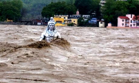
Floods in India : Shiva statue being washed away once more in Rishikesh, Haridwar in Uttarakhand
A new Shiva statue being washed away in Rishikesh, Haridwar in Uttarakhand, India, during floods on 20 Jun 2013. Photograph: Indian Photo Agency/Rex Features
Natural disasters often follow a predictable path in India. A flood or an earthquake happens every few years, the government blames the vagaries of nature, the right sympathetic noises are made, and all is forgotten until the next one comes along. But last week's cataclysmic floods in the northern Indian state of Uttarakhand, surrounded by the Himalayas, have provoked a debate on whether this particular disaster was caused - or at least worsened - by reckless human greed.
At last count, 5000 people are feared killed, and the number is expected to rise further. More than 33,000 people have been rescued in an amazing effort by the Indian army, but an estimated 19,000 victims are still stranded.
On the face of it, the floods seem like a calamity that was unpreventable. The Indian meterological department reported a record rainfall of 385 mm during the first few weeks of June, which is 440 per cent over the usual rainfall. But green groups say that while a cloudburst may have been the immediate cause of floods, the region has been slowly eroded by rampant development. Too many roads, hotels and buildings have caused the valley to collapse like a stack of dominoes.
The government is blaming a massive "tsunami", but this easy blame masks its criminal neglect of disaster systems and history of ignoring danger signs. A report released by the Comptroller and Auditor General in April 2013 revealed that the State Disaster Management Authority has never met, has received no funds, and has framed no plan to cope with disaster, despite a series of deadly landslides over the past few years.


Read More Here