Showing posts with label Earthquakes. Show all posts

Sunday, December 20, 2015

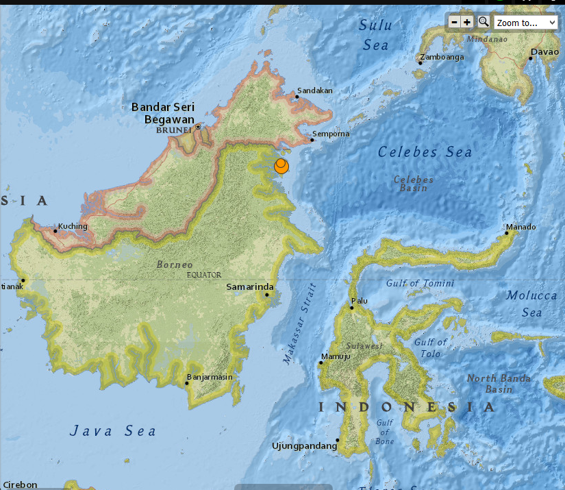
Indonesia - 6.0 Magnitude Earthquake with 4.6 registered not long after , 12/20/2015


 photo Indonesia 6.0 mag EQ 12.20.2015_zpstfcxfd6c.png
Indonesia 6.0 Magnitude EQ 12/20/2015

..........

2 earthquakes in map area

  1. M 4.6 - 38km ESE of Sembakung, Indonesia

    2015-12-20 21:38:39 UTC 10.0 km

  2. M 6.0 - 36km N of Tarakan, Indonesia

    2015-12-20 18:47:35 UTC 9.0 km


..........


...........

NOAA's National Weather Service

Tsunami.gov
Current date and time is: Dec 21, 2015 01:59 UTC
No Tsunami Warnings, Advisories or Watches are in effect
 
 
..........


The Japan Times

Borneo buffeted by strong, shallow M6.0 temblor but no tsunami threat: USGS

AFP-JIJI
 
A strong 6.0 magnitude earthquake struck Indonesia early on Monday, the U.S. Geological Survey (USGS) said, but no immediate damage or casualties were reported.

The quake, which was relatively shallow, struck the northeastern corner of Kalimantan on the Indonesian part of Borneo island, 34 km (21 miles) north of the coastal city of Tarakan, according to the USGS.

The agency reported the quake hitting at a depth of 22 km.

Indonesia’s tsunami warning center said there was no potential for the quake to trigger tsunami. There were also no immediate reports of damage.


Read More Here

...........

Friday, December 18, 2015

Philippines - 5.2 Magnitude earthquake registered near the town of San Juan in Ilocos Sur


5.2-magnitude quake hits Ilocos Sur, aftershocks expected - Phivolcs

51

The earthquake struck near the town of San Juan, Ilocos Sur, the Philippine Institute of Volcanology and Seismology says.

Metro Manila (CNN Philippines) — A 5.2-magnitude earthquake struck near the town of San Juan in Ilocos Sur on Thursday evening (December 17), according to the Philippine Institute of Volcanology and Seismology (Phivolcs).

Aftershocks are expected, it added.

The United States Geological Survey (USGS), however, said the quake that struck at 8:44 p.m. had a magnitude of 5.4.

Strong quake felt in one town

Based on Phivolcs' earthquake intensity scale, an Intensity 5 or a strong quake was reported in the town of Sinait, more than 30 minutes drive from the town of San Juan.


Read More Here

Thursday, December 17, 2015

Mexico - Magnitude 6.6 earthquake registered - 9km ENE of Tres Picos


THE WATCHERS

M6.4 earthquake hits Chiapas, Mexico

 
M6.4 earthquake hits Chiapas, Mexico
A strong earthquake with recorded magnitude of M6.4 (USGS) hit Chiapas, Mexico at 19:49 UTC on December 17, 2015. The agency is reporting a depth of 96.9 km (60.2 miles). EMSC is reporting M6.4 at a depth of 120 km (74.5 miles). 
According to the USGS, the epicenter was located 11 km (7 miles) ENE of Tres Picos, 30 km (19 miles) NW of Pijijiapan, 40 km (25 miles) ESE of Tonala, 62 km (39 miles) SE of Arriaga, Mexico and 342 km (213 miles) WNW of Guatemala City, Guatemala.
There are about 743 880 people living within 100 km (62 miles) radius.


Read More Here
..........

M 6.6 - 9km ENE of Tres Picos, Mexico

............
USGS
...........

 NOAA's National Weather Service

Tsunami.gov

Current date and time is: Dec 18, 2015 03:28 UTC
No Tsunami Warnings, Advisories or Watches are in effect
 
............

Wednesday, December 9, 2015

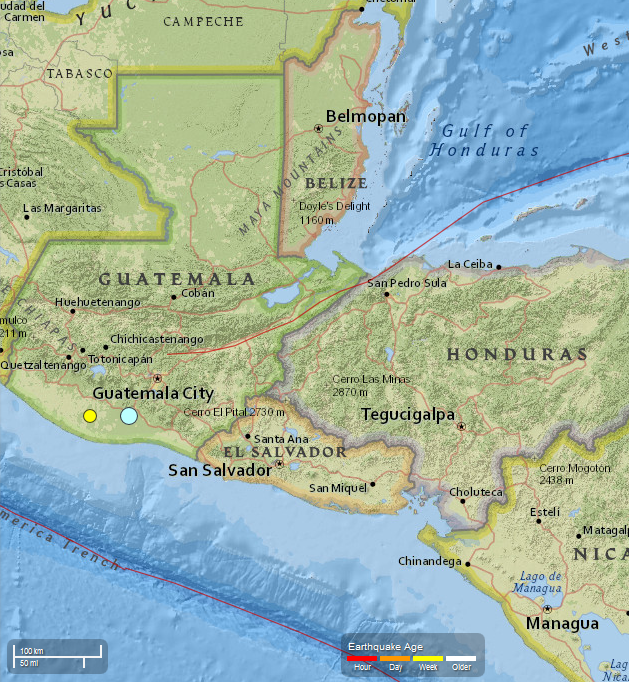
Guatemala - 5.7 Magnitude EQ recorded 12/07/2015. 4.4 Magnitude recorded 12/08/2015


..........
 photo Guatemala 5.7 Mag EQ_zps1pea8ugo.png
USGS
Guatemala   5.7 Magnitude EQ  12/07/2015
..........

2 earthquakes in map area

  1. M 4.4 - 1km NE of Nueva Concepcion, Guatemala

    2015-12-08 13:59:17 UTC 72.0 km

  2. M 5.7 - 1km NNW of Masagua, Guatemala

    2015-12-07 22:53:36 UTC 108.6 km


...........


............

Strong earthquake strikes near Escuintla in Guatemala, southwest of capital city

PUBLISHED Mon, December 07, 2015 - 6:27pm EST

Credit: Google
 
 
A strongly felt earthquake with a preliminary magnitude of 5.7 has struck near the city of Escuintla in south central Guatemala, not far from the capital, seismologists say. (more)

The earthquake, which struck at 4:53 p.m. local time on Monday, was centered next to Masagua about 12 kilometers (7 miles) southwest of Escuintla, or 59 kilometers (37 miles) southwest of Guatemala City. It struck about 108.6 kilometers (67.5 miles) deep, making it a relatively deep earthquake, according to the United States Geological Survey (USGS).


Read More Here


...........


Friday, December 4, 2015

A recent study found that the historical occurrence of earthquakes in the eastern Mediterranean Sea has been much more plentiful than previously thought.


Dec 01, 2015 03:03 PM EST
 
Tectonic plates in the eastern Mediterranean
 
A recent study found that the historical occurrence of earthquakes in the eastern Mediterranean Sea has been much more plentiful than previously thought. They have suggestions for precautions to take, considering that. (Photo : Wikimedia Commons)
 
 
There is more seismic activity in the eastern Mediterranean than was previously thought, and a study about this was recently accepted for publication in the journal Geophysical Research Letters.
Historically in the long stretch of geological time, seismic activity near and around Crete has stirred up bursts of earthquakes, and this may increase the region's future risk of earthquakes and tsunamis, according to a release.

Several tectonic plates are in the Mediterranean basin, caused by the African and Eurasian Plates crashing together there. While scientists have been aware that the collision between the two plates can make the eastern part of that sea and land area susceptible to earthquakes, they've also been confused by the region having gone through only two (known) earthquakes larger than 8 on the Richter scale in 4,000 years.

The African Plate goes under the Aegean microplate just south of Crete. This occurs in an area shaped like an arc, which is called the Hellenic margin. The scientists in the study looked at the history of earthquakes in this subduction zone, to learn what could drive mega-earthquakes in the area.

"We study the Hellenic subduction margin going back to about 50,000 years, which is about 10 times the time window of paleo-earthquake observations in the eastern Mediterranean that we had before," Vasiliki Mouslopoulou, at the GFZ German Research Center for Geosciences, and study lead author, in the release. "For the first time ever, we were able to chart the spatial and temporal pattern with which mega-earthquakes rupture the Hellenic margin."


Read More Here

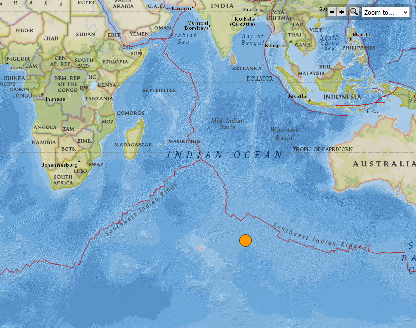
Magnitude 7.1 very strong and very shallow Earthquake - SOUTHEAST INDIAN RIDGE


...........
 
 
Globe with Earthquake Location

M7.1 - SOUTHEAST INDIAN RIDGE

Preliminary Earthquake Report
  • 4 Dec 0115 22:24:55 UTC
  • 5 Dec 2015 04:24:55 near epicenter
  • 4 Dec 2015 16:24:55 standard time in your timezone
  • 1020 km (632 mi) ENE of Heard Island, Heard Island and McDonald Islands
  • 2961 km (1835 mi) SW of Busselton, Australia
  • 3005 km (1863 mi) SW of Bunbury, Australia
  • 3048 km (1889 mi) SW of Albany, Australia
  • 3124 km (1936 mi) SW of Perth, Australia

Location Uncertainty

Horizontal: 8.6 km;
Vertical 1.8 km

Parameters

Nph = 89; Dmin = 1118.9 km;
Rmss = 0.98 seconds; Gp = 42°
Version =Event IDus 100043z2
For updates, maps, and technical information, see: Event Page or USGS Earthquake Hazards Program
...........
 photo Southeast Indian Ridge 7.1 Mag EQ_zps9quhwvik.png
Southeast Indian Ridge 7.1 Magnitude EQ
USGS
............

M 7.1 - Southeast Indian Ridge

Time
2015-12-04 22:24:55 UTC
Location
47.643°S 85.093°E
Depth
10.0 km
..........

M 7.1 - Southeast Indian Ridge

..........

Tuesday, December 1, 2015

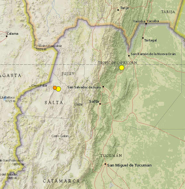
Argentina earthquake: Magnitude 5.9 hits Jujuy and Salta near San Salvador. Two additional quakes registered within the next two days at 5.1 and at 4.5


..........

Argentina 5.9 Magnitude EQ 11/29/2015 photo Argentina 5.9 mag EQ_zpst6sagbyf.png
USGS     Argentina 5.9 Magnitude EQ 
..........

3 earthquakes in map area

  1. M 4.5 - 80km W of San Antonio de los Cobres, Argentina

    2015-12-01 07:20:37 UTC 172.4 km

  2. M 5.1 - 67km W of San Antonio de los Cobres, Argentina

    2015-11-30 14:45:22 UTC 158.9 km

  3. M 5.9 - 17km NW of Yuto, Argentina

    2015-11-29 18:52:49 UTC 9.6 km


..........


...........

Argentina earthquake: Tremor hits Jujuy and Salta near San Salvador

PUBLISHED Sun, November 29, 2015 - 2:09pm EST
A strong earthquake with a preliminary magnitude of 5.9 has struck the provinces of Jujuy and Salta in northwest Argentina, near the city of San Salvador de Jujuy, seismologists say. (more)


The earthquake struck at 3:52 p.m. local time and was centered about 9 kilometers west of Yuto, or 91 kilometers northeast of San Salvador de Jujuy. It struck about 10 kilometers deep, making it a shallow earthquake, according to seismologists.

Residents in the region reported feeling the earthquake, but there was no immediate word on damage or casualties.


Read More Here

..........
Sunday, November 29, 2015

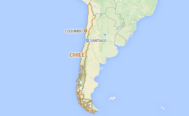
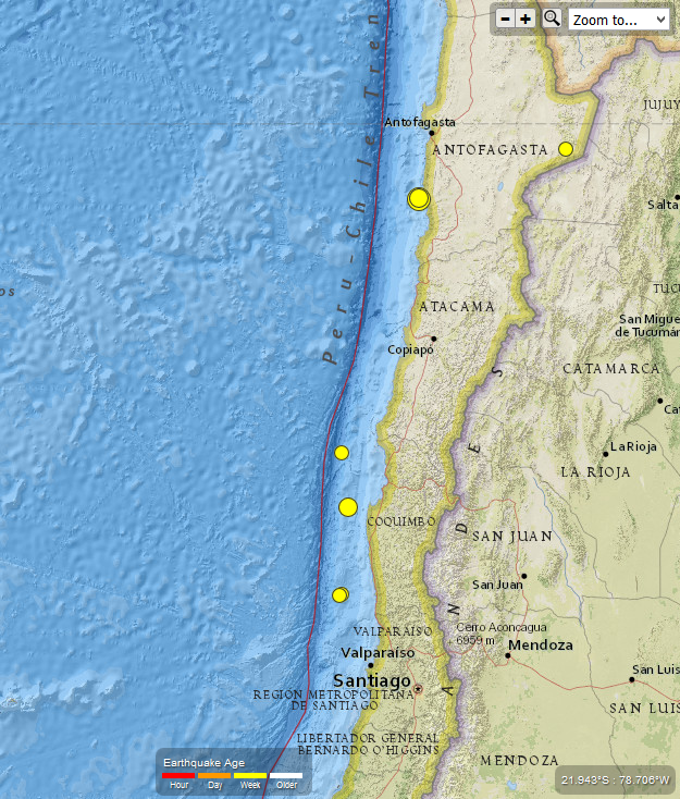
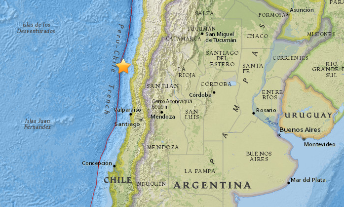
Earthquake - Magnitude 6.2 - 66km NNW of Taltal, Chile. Total of 7 earthquakes in 7 days ranging in magnitude from 4.6 to 6.2.


Magnitude 6.2 Earthquake Hits Off Chile Coast, No Damage Reported

 
Magnitude 6.2 Earthquake Hits Off Chile Coast, No Damage Reported
Santiago:  A magnitude 6.2 earthquake struck off the northern coast of Chile on Friday, the U.S. Geological Survey said, although there were no initial reports of damage.
The USGS said the quake's epicentre was located 18 miles (29 kilometres) below the seabed, 82 miles (132 km) southwest of Antofagasta.
The quake, initially reported as a magnitude 6.0, struck at 6 p.m. (2100 GMT).
 
 
Read More Here
 
 
.......................................................................................................
 
 photo Chile 6.2 Mag Earthquake_zpsf778htz8.png
USGS
Chile - 6.2 Magnitude Earthquake 11/27/2015 Total of 7 EQ in last 7 days
..........

7 earthquakes in map area

  1. M 5.2 - 81km WSW of Coquimbo, Chile

    2015-11-28 05:44:40 UTC 10.0 km

  2. M 5.0 - 68km NNW of Taltal, Chile

    2015-11-27 21:45:12 UTC 45.3 km

  3. M 6.2 - 66km NNW of Taltal, Chile

    2015-11-27 21:00:22 UTC 35.0 km

  4. M 4.6 - 103km NW of Coquimbo, Chile

    2015-11-25 20:57:58 UTC 10.0 km

  5. M 4.7 - 104km WSW of Illapel, Chile

    2015-11-24 21:19:55 UTC 10.0 km

  6. M 4.8 - 101km WSW of Illapel, Chile

    2015-11-24 09:14:16 UTC 13.9 km

  7. M 4.6 - 123km SSE of San Pedro de Atacama, Chile

    2015-11-23 05:16:24 UTC 121.0 km

..........
 
..........
 
..........

Wednesday, November 25, 2015

5.1-magnitude earthquake in the state of Mérida triggered a rockslide. 1 fatality reported


One killed in rockslide triggered by earthquake in Venezuela

 
By Andrew V. Pestano Follow @AVPLive9 Contact the Author   |   Nov. 23, 2015 at 1:50 PM


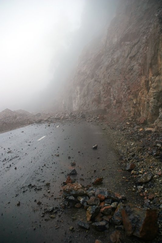
A rockslide similar to the one pictured caused two vehicles to crash in Venezuela, killing one man. The slide was triggered by an earthquake. File photo by GCRO Images/Shutterstock
 
CARACAS, Venezuela, Nov. 23 (UPI) -- One person was killed in Venezuela when a rockslide was triggered by a 5.1-magnitude earthquake in the state of Mérida, causing a traffic collision.
 
The Venezuelan Foundation of Seismological Research, or FUNVISIS, reported the epicenter of the earthquake was located about 18 miles southeast of the town of El Vigía at 4:08 p.m. at a depth of about 3 miles. Multiple aftershocks were recorded in the region.

Blas Federico Méndez, 41, died immediately and his son Emmanuel Méndez, 32, was injured after their vehicle made a frontal collision with an SUV. Both vehicles attempted to evade debris from a rockslide, but collided in the process. Two people inside the SUV were injured, El Universal reported.


Read More Here

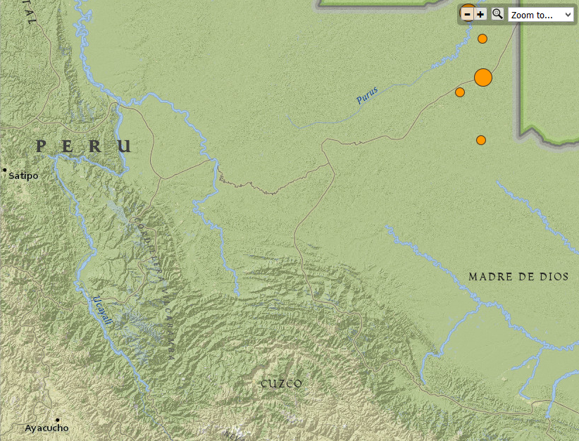
Peru and Brazil 7.6 Magnitude Earthquake. Total of 6 registered earthquakes ranging in magnitude from 4.6 to 7.6. 11/24/2015


Peru 7.6Mag Earthquake photo Peru 7.6 Mag earthquake_zpsnibcs37w.png
Peru 7.6 Magnitude Earthquake  11/24/2015
USGS
..........

4 earthquakes in map area

  1. M 4.6 - 150km WNW of Iberia, Peru

    2015-11-25 00:28:16 UTC 600.0 km

  2. M 4.5 - 189km NW of Iberia, Peru

    2015-11-24 23:55:20 UTC 616.9 km

  3. M 4.6 - 181km WNW of Iberia, Peru

    2015-11-24 23:44:12 UTC 595.1 km

  4. M 7.6 - 169km WNW of Iberia, Peru

    2015-11-24 22:45:38 UTC 600.6 km


..........


..........

NOAA's National Weather Service

Tsunami.gov
Current date and time is: Nov 25, 2015 20:34 UTC
No Tsunami Warnings, Advisories or Watches are in effect
 
..........
Globe with Earthquake Location

M7.6 - PERU-BRAZIL BORDER REGION

Preliminary Earthquake Report
Magnitude7.6
Date-Time
  • 24 Nov 2015 22:50:52 UTC
  • 24 Nov 2015 17:50:53 near epicenter
  • 24 Nov 2015 16:50:52 standard time in your timezone
Location10.070S 70.981W
Depth606 km
Distances
  • 208 km (128 mi) NW of Iberia, Peru
  • 212 km (131 mi) S of Tarauaca, Brazil
  • 221 km (137 mi) SSW of Feijo, Brazil
  • 264 km (163 mi) WNW of Cobija, Bolivia
  • 695 km (430 mi) ENE of Lima, Peru
Location UncertaintyHorizontal: 10.0 km; Vertical 7.0 km
ParametersNph = 90; Dmin = 320.8 km; Rmss = 1.13 seconds; Gp = 61°
Version =
Event IDus 100040x6 ***This event has been revised.
..........
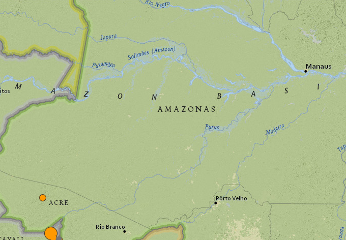
Brazil  7.6 Mag Earthquake photo Brazil 7.6 Mag Earthquake_zpsht5uhemk.png
Brazil 7.6 Mag Earthquake   11/24/2015
USGS
..........

2 earthquakes in map area

  1. M 4.6 - 78km WSW of Tarauaca, Brazil

    2015-11-25 09:26:23 UTC 641.9 km

  2. M 7.6 - 210km S of Tarauaca, Brazil 2015-11-24 22:50:53 UTC 611.7 km


..........
..........

..........

Monday, November 23, 2015

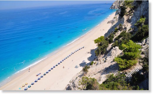
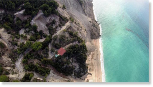
Video of the moment an earthquake hits in Lefkada, Greece


Βίντεο την στιγμή του σεισμού στην Λευκάδα

Video of the moment an earthquake hits in  Lefkada, Greece


Read More Here

Thursday, November 19, 2015

Strong undersea earthquake strikes near Solomon Islands. Magnitude 7.0 followed by a 5.1


The Sydney Morning Herald

Date
November 19, 2015 - 7:24AM
Image showing epicentre of Solomon Islands earthquake.

Image showing epicentre of Solomon Islands earthquake. Photo: USGS

A strong undersea earthquake has struck off the coast near the Solomon Islands, according to the Bureau of Meteorology.

The bureau initially reported that an earthquake of 7.1 had occurred at 5.31am ADET, which would be classified as a major earthquake, but the intensity was later reported as 6.8, which is considered strong.


...........................................................................................
 
 
..........
..........
 
Current date and time is: Nov 19, 2015 08:13 UTC
No Tsunami Warnings, Advisories or Watches are in effect
 
..........

11/19/2015 : 8 Earthquakes registered in Lakeview, Oregon ranging in magnitude from 2.5 to 4.2


City Data . com
..........

8 earthquakes

  1. M 3.0 - 70km ESE of Lakeview, Oregon

    2015-11-19 05:50:58 UTC 10.7 km

  2. M 2.8 - 68km ESE of Lakeview, Oregon

    2015-11-19 05:48:48 UTC 11.3 km

  3. M 3.4 - 69km ESE of Lakeview, Oregon

    2015-11-19 05:27:21 UTC 10.8 km

  4. M2.7 - 69km ESE of Lakeview, Oregon

    2015-11-19 02:17:39 UTC 11.0 km


  5. M 2.5 - 69km ESE of Lakeview, Oregon 

    2015-11-19 02:15:32 UTC 10.5 km

  6. M 2.6 - 68km ESE of Lakeview, Oregon

    2015-11-19 02:01:42 UTC 11.4 km

  7. M 4.0 - 69km ESE of Lakeview, Oregon

    2015-11-19 01:50:17 UTC 12.1 km

  8. M 4.2 - 70km ESE of Lakeview, Oregon

    2015-11-19 01:40:02 UTC 12.9 km


..........


..........

..........


Wednesday, November 18, 2015

Violent Shaking Along The Ring Of Fire Continues A Progression Of Disasters That Began In September


The Economic Collapse

Are You Prepared For The Coming Economic Collapse And The Next Great Depression?
The Ring Of Fire - Photo from Wikipedia


Have you noticed that seismic activity along the Ring of Fire appears to be dramatically increasing?  According to Volcano Discovery, 39 volcanoes around the world have recently erupted, and 32 of them are associated with the Ring of Fire.  This includes Mt. Popocatepetl which sits only about 50 miles away from Mexico City’s 18 million inhabitants.  If you are not familiar with the Ring of Fire, it is an area roughly shaped like a horseshoe that runs along the outer perimeter of the Pacific Ocean.  Approximately 90 percent of all earthquakes and approximately 75 percent of all volcanic eruptions occur along the Ring of Fire.  Just within the last 24 hours, we have witnessed a 4.4, a 5.4 and a 5.7 earthquake in Alaska, a 6.8 earthquake in Chile and 20 earthquakes in Indonesia of at least magnitude 4.3.  And as you will see below, this violent shaking along the Ring of Fire seems to continue a progression of major disasters that began back during the month of September.

For whatever reason, our planet suddenly seems to be waking up.  Unfortunately, the west coast of the United States is one of the areas where this is being felt the most.  The little city of San Ramon, California is about 45 miles east of San Francisco, and over the past several weeks it has experienced a record-breaking 583 earthquakes

A total of 583 small earthquakes have shaken San Ramon, California, in the last three weeks or so – more than five times the record set 12 years ago, according to the latest US Geological Survey updates.

“It’s the swarm with the largest number of total earthquakes in San Ramon,” said USGS scientist David Schwartz, who is more concerned about the size of quakes than he is the total number of them. Still, the number tops the previous record set in 2003, when 120 earthquakes hit over 31 days, with the largest clocking in at a magnitude of 4.2.

Could this be a prelude to a major seismic event in California?

We shall see what happens.

Meanwhile, records are being shattered in the middle part of the country as well.

For instance, the state of Oklahoma has already set a brand new yearly record for earthquakes

The state recorded its 587th earthquake of 3.0 magnitude or higher early this week, breaking the previous record of 585. That record was set for all of 2014, meaning that Oklahoma has now had more 3.0 magnitude or higher earthquakes so far in 2015 than it did in all of 2014. So far this year, E&E News reports, Oklahoma’s averaged 2.5 quakes each day, a rate that, if it continues, means the state could see more than 912 earthquakes by the end of this year.

Oklahoma has also experienced 21 4.0 magnitude or greater earthquakes so far this year — an increase over last year, which saw 14.

And just over this past weekend there was a very disturbing series of earthquakes in the state

Starting with a magnitude-4.1 temblor at 5:11 a.m. close to the Oklahoma-Kansas border, the region experienced a series of six earthquakes within a 75-minute period Saturday morning, the U.S. Geological Survey reported on its website.

The largest earthquake Saturday morning was the 4.1, which had an epicenter nine miles northwest of Medford, Okla., 59 miles southwest of Wichita.

That was followed by five more quakes near Medford with magnitudes of 2.5, 2.8, 2.5, 3.1 and 2.9 – the last of which came at 6:24 a.m.

A seventh earthquake – this one a magnitude-4.2 temblor – was recorded at 12:29 p.m., 10 miles north-northwest of Medford.

So why aren’t more Americans alarmed that these records are being broken?


Read More Here

Wednesday, November 11, 2015

Two Earthquakes - Magnitude 6.9 - 93km NW of Coquimbo, Chile. Total of 13 earthquakes registered ranging in magnitude from 4.0 to 6.9.

.


6.9 quake, powerful aftershocks strike off Chilean coast

 
© earthquake.usgs.gov
A 6.9 magnitude earthquake has struck off the coast of Chile, some 100 kilometers west of Coquimbo, according to USGS. 

The epicenter of the earthquake was located at a depth of just 10 kilometers (6.2 miles), according to the United States Geological Survey, which initially reported it as having a magnitude 6.6.

USGS reports a M6.6 88km NW of Coquimbo, Chile on 11/11/15 @ 1:54:37 UTC http://earthquake.usgs.gov/earthquakes/eventpage/us10003x8t 

13 earthquakes in map area

  1. 5.1 78km NW of Coquimbo, Chile 2015-11-11 03:07:49 UTC 15.2 km
  2. M 6.9 - 98km NW of Coquimbo, Chile

     2015-11-11 02:46:19 UTC 10.0 km

  3. 5.1 83km NW of Coquimbo, Chile 2015-11-11 02:23:38 UTC 10.0 km
  4. 4.9 81km NW of Coquimbo, Chile 2015-11-11 02:18:08 UTC 35.0 km
  5. 4.8 89km NW of Coquimbo, Chile 2015-11-11 02:14:39 UTC 10.0 km
  6. 4.9 76km NW of Coquimbo, Chile 2015-11-11 02:06:36 UTC 10.0 km
  7. M 6.9 - 93km NW of Coquimbo, Chile

    2015-11-11 01:54:37 UTC 10.0 km

  8. 4.4 92km NW of Coquimbo, Chile 2015-11-10 23:48:24 UTC 10.0 km
  9. 4.1 36km SW of Ovalle, Chile 2015-11-10 19:38:22 UTC 50.1 km
  10. 4.0 33km NNE of Calama, Chile 2015-11-10 18:06:20 UTC 111.1 km
  11. 5.7 35km NE of Calama, Chile 2015-11-10 17:48:22 UTC 112.5 km
  12. 4.6 33km SW of Ovalle, Chile 2015-11-10 12:58:37 UTC 37.6 km
  13. 4.4 101km WNW of Coquimbo, Chile 2015-11-10 11:43:46 UTC 10.0 km

..........


..........


..........

NOAA's National Weather Service

Tsunami.gov
 
Current date and time is: Nov 11, 2015 06:32 UTC
No Tsunami Warnings, Advisories or Watches are in effect
 
..........