Showing posts with label Argentina. Show all posts

Tuesday, December 1, 2015

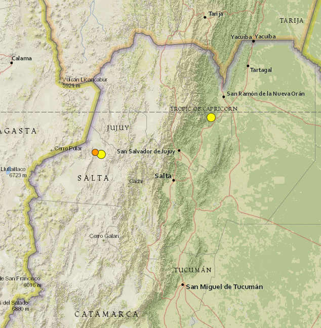
Argentina earthquake: Magnitude 5.9 hits Jujuy and Salta near San Salvador. Two additional quakes registered within the next two days at 5.1 and at 4.5


..........

Argentina 5.9 Magnitude EQ 11/29/2015 photo Argentina 5.9 mag EQ_zpst6sagbyf.png
USGS     Argentina 5.9 Magnitude EQ 
..........

3 earthquakes in map area

  1. M 4.5 - 80km W of San Antonio de los Cobres, Argentina

    2015-12-01 07:20:37 UTC 172.4 km

  2. M 5.1 - 67km W of San Antonio de los Cobres, Argentina

    2015-11-30 14:45:22 UTC 158.9 km

  3. M 5.9 - 17km NW of Yuto, Argentina

    2015-11-29 18:52:49 UTC 9.6 km


..........


...........

Argentina earthquake: Tremor hits Jujuy and Salta near San Salvador

PUBLISHED Sun, November 29, 2015 - 2:09pm EST
A strong earthquake with a preliminary magnitude of 5.9 has struck the provinces of Jujuy and Salta in northwest Argentina, near the city of San Salvador de Jujuy, seismologists say. (more)


The earthquake struck at 3:52 p.m. local time and was centered about 9 kilometers west of Yuto, or 91 kilometers northeast of San Salvador de Jujuy. It struck about 10 kilometers deep, making it a shallow earthquake, according to seismologists.

Residents in the region reported feeling the earthquake, but there was no immediate word on damage or casualties.


Read More Here

..........

Sunday, October 18, 2015

A magnitude 5.9 earthquake struck northwest Argentina on Saturday, leaving at least one person dead

Channel News Asia

Earthquake hits northwest Argentina, kills one; injuries reported

A magnitude 5.9 earthquake struck northwest Argentina on Saturday, the U.S. Geological Survey reported, leaving at least one person dead, injuring several more and damaging homes, according to local media.

BUENOS AIRES: A magnitude 5.9 earthquake struck northwest Argentina on Saturday, the U.S. Geological Survey reported, leaving at least one person dead, injuring several more and damaging homes, according to local media.

"Homes collapsed, families have been left with nothing, schools have been destroyed. We have one fatality, who was crushed," Hector Romero, mayor of El Galpon, some 160 km from the provincial capital of Salta, told a local radio station.

"Currently there is one woman dead and injured people are being treated at the local hospital," said Ernesto Flores, undersecretary with Salta's civil defence authority, according to state-run news agency Telam.


Read More Here

Saturday, October 10, 2015

Biological Hazard - Argentina, Province of Buenos Aires, : Anthrax (Cattle)


medindia.net
..........
 October 09 2015 11:49 AMBiological HazardArgentinaProvince of Buenos Aires, [The area was not defined]Damage levelDetails
..........

RSOE EDIS  Event Report

Description
Laboratoria Azul in Argentina reported Tuesday that a young heifer that had died suddenly has tested positive for anthrax. Laboratoria Azul Co-Director Ramon Noseda said the heifer came from a herd of approximately 1,300 animals, the area where the herd is located in Buenos Aires Province, which has had past cases of enzootic anthrax. Noseda said that three other heifers died in a similar fashion and the problem was recognized by a veterinarian. Sanitary controls have been established. Anthrax outbreaks among cattle have been reported in the country seven times since 2006, the most recent taking place this year. Argentine officials have established vaccination requirements for ranchers, but there are some ranchers that fail to vaccinate their herds. The Merck Veterinary Manual states that anthrax is most commonly found in livestock animals, including sheep, goats, cattle and other herbivorous animals. The disease is able to be spread to the human population through contact or exposure to infected tissue from meat. They also report that soil can act as a reservoir for anthrax spores for several years. Anthrax often presents itself as a severe illness in humans and animals with the potential to be fatal.
Biohazard name:Anthrax
Biohazard level:4/4 Hazardous
Biohazard desc.:Viruses and bacteria that cause severe to fatal disease in humans, and for which vaccines or other treatments are not available, such as Bolivian and Argentine hemorrhagic fevers, H5N1(bird flu), Dengue hemorrhagic fever, Marburg virus, Ebola virus, hantaviruses, Lassa fever, Crimean-Congo hemorrhagic fever, and other hemorrhagic or unidentified diseases. When dealing with biological hazards at this level the use of a Hazmat suit and a self-contained oxygen supply is mandatory. The entrance and exit of a Level Four biolab will contain multiple showers, a vacuum room, an ultraviolet light room, autonomous detection system, and other safety precautions designed to destroy all traces of the biohazard. Multiple airlocks are employed and are electronically secured to prevent both doors opening at the same time. All air and water service going to and coming from a Biosafety Level 4 (P4) lab will undergo similar decontamination procedures to eliminate the possibility of an accidental release.
Symptoms: 
Status:confirmed

..........

Bovine anthrax case confirmed in Argentina


Laboratoria Azul in Argentina reported Tuesday that a young heifer that had died suddenly has tested positive for anthrax.

Laboratoria Azul Co-Director Ramon Noseda said the heifer came from a herd of approximately 1,300 animals, the area where the herd is located in Buenos Aires Province, which has had past cases of enzootic anthrax. Noseda said that three other heifers died in a similar fashion and the problem was recognized by a veterinarian. Sanitary controls have been established.

Anthrax outbreaks among cattle have been reported in the country seven times since 2006, the most recent taking place this year. Argentine officials have established vaccination requirements for ranchers, but there are some ranchers that fail to vaccinate their herds.

..........

Saturday, March 22, 2014

Volcano Activity - MultiCountries, Argentina and Chile (Andes), [Copahue Volcano]


Earth Watch Report   -  Volcanic Actuivity

Copahue volcano, quiet at the surface, today (SERNAGEOMIN webcam)
.....
Volcano ActivityMultiCountriesArgentina and Chile (Andes), [Copahue Volcano]Damage levelDetails
.....

RSOE EDIS

Description
SERNAGEOMIN raised the alert level of the volcano to orange yesterday after an increase in seismic activity. A pulse of volcanic tremor was detected that could indicate magma moving into the volcano's plumbing system. On the surface, no unusual activity has been seen at the volcano so far, except that an increase in SO2 emissions (approx 2,300 tons / day) was measured. This supports the idea that magma has risen under the edifice. Whether this activity is followed by new eruptive activity remains to be seen. In most cases, intrusions of magma under volcanoes do never reach the surface, i.e. produce eruptions. ONEMI (Civil Defense) published a bulletin stating that civil alert remains at yellow for the highest risk areas, in particular the most proximal areas around the volcano itself, but also include the city of Alto Biobío located 40 km west of the volcano, because it is at the mouth of a valley that drains Copahue on the north side and therefore, a potential pathway for mud flows that could occur during an eruption.
......

Volcano Discovery

Copahue volcano
stratovolcano 2997 m / 9,833 ft
Chile/Argentina, -37.85°S / -71.17°W
Copahue webcams / live data
Copahue volcano videos
Copahue volcano eruptions:
2013, 2012, 2001(?), 2000, 1992, 1961, 1937, 1867(?), 1759(?), 1750
Typical eruption style:
explosive
Last earthquakes nearby
......
Wednesday, Mar 12, 2014
The volcano continues to show signs of unrest. A swarm of volcanic-tectonic earthquakes occurred the day before yesterday. SERNAGEOMIN keeps the alert level of the volcano at Yellow. [more]
......
Enhanced by Zemanta

Monday, November 25, 2013

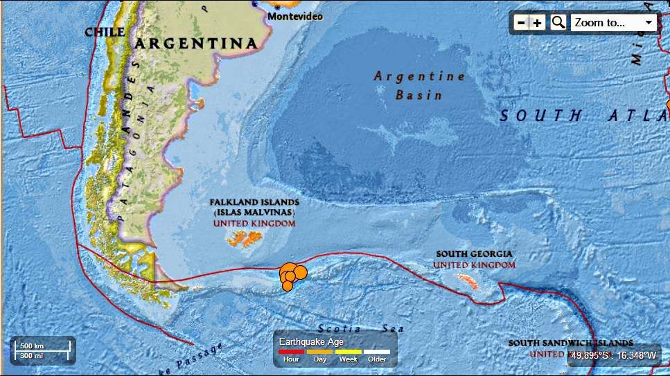
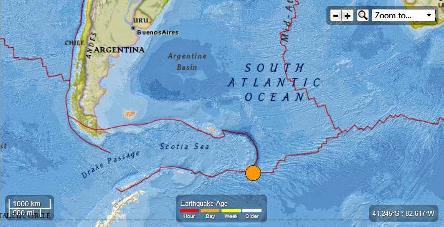
South Atlantic Ocean : 7.0 Magnitude Earthquake November 25th 2013

 Earth Watch Report  -  Earthquakes


South Atlantic Ocean  7.0 mag EQ November  25th  2013 photo SouthAtlanticOcean70magEQNovember25th2013_zpsc6660818.jpg

7 earthquakes in map area

  1. M 4.6 - South Atlantic Ocean

    2013-11-25 02:37:41 UTC-06:00 10.0 km

  2. M 4.6 - South Atlantic Ocean

    2013-11-25 01:56:10 UTC-06:00 10.0 km

  3. M 5.5 - South Atlantic Ocean

    2013-11-25 01:21:18 UTC-06:00 10.0 km

  4. M 5.4 - Falkland Islands region

    2013-11-25 00:41:50 UTC-06:00 14.3 km

  5. M 7.0 - South Atlantic Ocean

    2013-11-25 00:27:33 UTC-06:00 10.0 km

  6. M 5.6 - South Atlantic Ocean

    2013-11-25 00:27:09 UTC-06:00 11.9 km

  7. M 5.6 - South Atlantic Ocean

    2013-11-24 23:10:09 UTC-06:00 14.9 km


..........

M 7.0 - South Atlantic Ocean

 2013-11-25 06:27:33 UTC

Earthquake location 53.881°S, 54.882°W

Event Time

  1. 2013-11-25 06:27:33 UTC
  2. 2013-11-25 02:27:33 UTC-04:00 at epicenter
  3. 2013-11-25 00:27:33 UTC-06:00 system time

Location

53.881°S 54.882°W depth=10.0km (6.2mi)

Nearby Cities

  1. 314km (195mi) SE of Stanley, Falkland Islands
  2. 877km (545mi) E of Ushuaia, Argentina
  3. 998km (620mi) ESE of Rio Gallegos, Argentina
  4. 1031km (641mi) SE of Puerto Deseado, Argentina
  5. 314km (195mi) SE of Stanley, Falkland Islands
.........

Additional Commentary

The November 25, 2013 M7.0 earthquake (06:27:33 UTC) southwest of the Falkland Islands in the South Atlantic Ocean occurred as the result of strike slip faulting, on either a left-lateral fault striking ENE-WSW, or a right-lateral structure striking NNW-SSE.  The location of the earthquake, near the ENE-WSW trending plate boundary between the South America and Scotia tectonic plates, suggests it is likely associated with left-lateral faulting along this margin. At the location of this earthquake, the Scotia plate moves ENE with respect to South America at a rate of approximately 9.5 mm/yr.
The November 25, 06:27:33 earthquake was the largest of 5 M5+ events that occurred in a similar area over an approximate 2-hour period, including a M5.6 earthquake 24 seconds prior to the M7.0 mainshock. Though this region experiences moderate-sized earthquakes relatively frequently – 15 M5+ events have occurred within 250 km of the November 25 earthquake over the past 40 years – large events are fairly uncommon. The largest nearby earthquake over the same time period was a M6.6 event in September 1993, 210 km to the east of the November 25 earthquake.
..........

Magnitude-7.0 earthquake strikes South Atlantic near Falkland Islands; follows four other large quakes


BUENOS AIRES, Argentina - The U.S. Geological Survey says a magnitude-7.0 earthquake has struck in the South Atlantic, southwest of the disputed Falkland Islands.
It says the quake struck at 2:27 a.m. Monday (0627 GMT), about 195 miles (314 miles) southeast of the Falklands' capital, Stanley, and 545 miles east of Ushuaia, Argentina. The depth was a shallow 6.2 miles (10 kilometres).
Enhanced by Zemanta

Friday, November 15, 2013

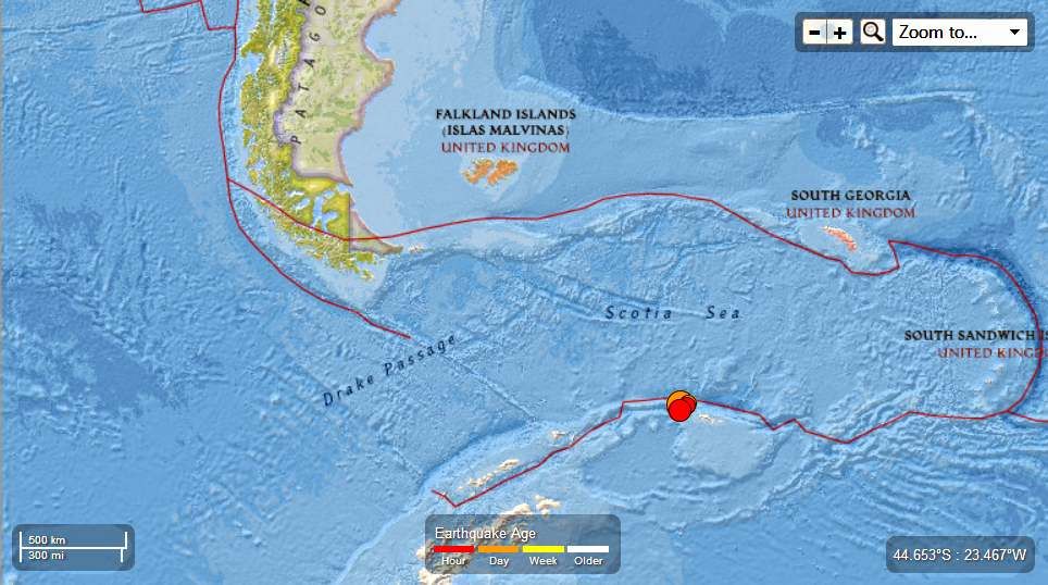
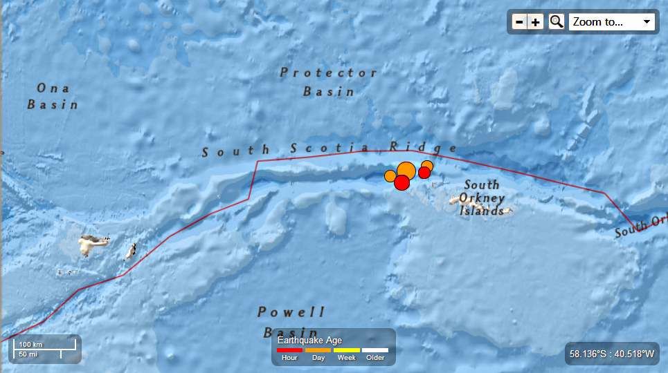
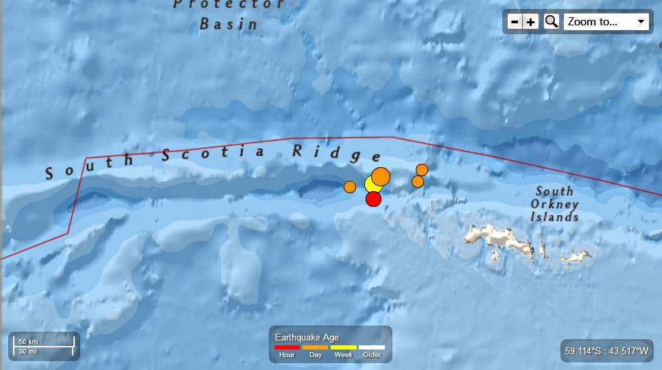
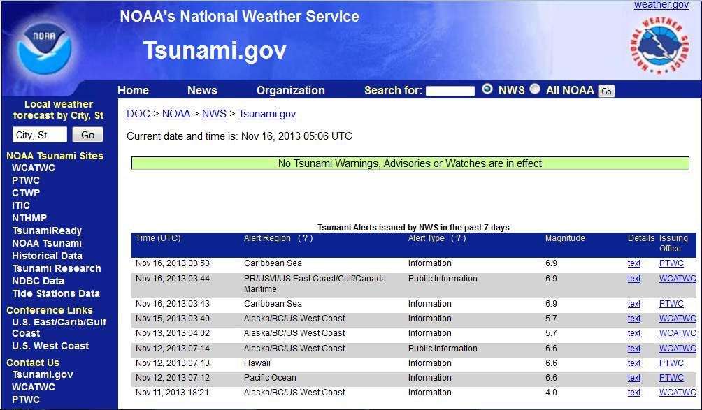
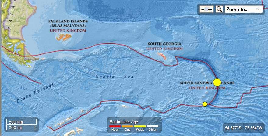
Scotia Sea - 6.8 Magnitude Earthquake total of 6 quakes ranging from 4.4 to 6.8 magnitude in the last 3 days

Earth Watch Report  -  Earthquakes

Scotia Sea  -  6.8 Mag EQ  November 15th  2013 a photo ScotiaSea-68MagEQNovember15th2013a_zps4c8b89e0.jpg
.....

Scotia Sea  -  6.8 Mag EQ  November 15th  2013 b photo ScotiaSea-68MagEQNovember15th2013b_zps7fece93f.jpg

5 earthquakes in map area

  1. M 5.3 - Scotia Sea   2013-11-15 22:45:33 UTC-06:00 10.0 km

  2. M 4.8 - Scotia Sea  2013-11-15 22:16:04 UTC-06:00 10.2 km

  3. M 4.9 - Scotia Sea  2013-11-15 22:01:18 UTC-06:00 10.3 km

  4. M 6.8 - Scotia Sea  2013-11-15 21:34:31 UTC-06:00 10.0 km

  5. M 4.4 - Scotia Sea  2013-11-15 02:10:17 UTC-06:00 10.0 km


Scotia Sea  -  6 EQ mag 4.4 to 6.8  last 7 days  November 15th  2013 photo ScotiaSea-6EQmag44to68last7daysNovember15th2013_zps3664aa2d.jpg

Scotia Sea  -  6 EQ mag 4.4 to 6.8  last 3 days  November 15th  2013
6 earthquakes in map area
  1. 5.3 Scotia Sea 2013-11-15 22:45:33 UTC-06:00 10.0 km
  2. 4.8 Scotia Sea 2013-11-15 22:16:04 UTC-06:00 10.2 km
  3. 4.9 Scotia Sea 2013-11-15 22:01:18 UTC-06:00 10.3 km
  4. 6.8 Scotia Sea 2013-11-15 21:34:31 UTC-06:00 10.0 km
  5. 4.4 Scotia Sea 2013-11-15 02:10:17 UTC-06:00 10.0 km
  6. 6.1 Scotia Sea 2013-11-13 17:45:48 UTC-06:00 10.0 km

.....

M 6.8 - Scotia Sea

 2013-11-16 03:34:31 UTC

Earthquake location 60.213°S, 47.108°W

Event Time

  1. 2013-11-16 03:34:31 UTC
  2. 2013-11-16 00:34:31 UTC-03:00 at epicenter
  3. 2013-11-15 21:34:31 UTC-06:00 system time

Location

60.213°S 47.108°W depth=10.0km (6.2mi)

Nearby Cities

  1. 917km (570mi) SW of Grytviken, South Georgia and the South Sandwich Islands
  2. 1397km (868mi) SE of Ushuaia, Argentina
  3. 1644km (1022mi) SE of Punta Arenas, Chile
  4. 1668km (1036mi) SE of Rio Gallegos, Argentina
  5. 1158km (720mi) SSE of Stanley, Falkland Islands
.....

Instrumental Intensity

ShakeMap Intensity Image
.....
Scotia Sea  -  6.8 Mag EQ  November 15th  2013 photo ScotiaSea-68MagEQNovember15th2013_zpsf139f398.jpg
.....
Enhanced by Zemanta

Saturday, July 27, 2013

South Sandwich Islands - 6.2 Magnitude and 4.6 Magnitude Earthquake July 26th, 2013

Earth Watch Report  -  Earthquakes


 photo SouthSandwichIslands-62MagEQJuly26th2013_zpsedd09341.jpg
...

M6.2 - 203km NE of Bristol Island, South Sandwich Islands

 2013-07-26 21:32:59 UTC

 
Earthquake location 57.789°S, 23.959°W

Event Time

  1. 2013-07-26 21:32:59 UTC
  2. 2013-07-26 19:32:59 UTC-02:00 at epicenter
  3. 2013-07-26 16:32:59 UTC-05:00 system time

Location

57.789°S 23.959°W depth=10.0km (6.2mi)

Nearby Cities

  1. 203km (126mi) NE of Bristol Island, South Sandwich Islands
  2. 2715km (1687mi) ESE of Ushuaia, Argentina
  3. 2937km (1825mi) ESE of Rio Gallegos, Argentina
  4. 2952km (1834mi) ESE of Punta Arenas, Chile
  5. 2258km (1403mi) ESE of Stanley, Falkland Islands
...

Instrumental Intensity

ShakeMap Intensity Image

...

M4.6 - 152km S of Bristol Island, South Sandwich Islands

 2013-07-26 02:38:05 UTC

Earthquake location 60.398°S, 26.807°W

Event Time

  1. 2013-07-26 02:38:05 UTC
  2. 2013-07-26 00:38:05 UTC-02:00 at epicenter
  3. 2013-07-25 21:38:05 UTC-05:00 system time

Location

60.398°S 26.807°W depth=41.4km (25.7mi)

Nearby Cities

  1. 152km (94mi) S of Bristol Island, South Sandwich Islands
  2. 2512km (1561mi) ESE of Ushuaia, Argentina
  3. 2756km (1712mi) SE of Punta Arenas, Chile
  4. 2762km (1716mi) SE of Rio Gallegos, Argentina
  5. 2135km (1327mi) SE of Stanley, Falkland Islands

...


Enhanced by Zemanta

Monday, July 15, 2013

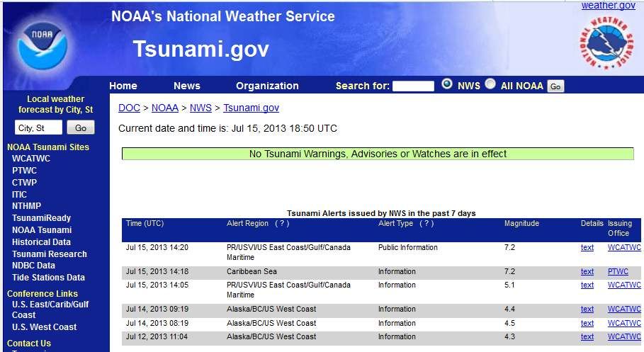
South Sandwich Islands - 7.3 Magnitude Earthquake - 216km SSE of Bristol Island

Earth Watch Report  -  Earthquakes

 photo SouthSandwichIslands-73MagEQJuly15th2013_zps223f9c99.jpg
....

M7.3 - 216km SSE of Bristol Island, South Sandwich Islands

 2013-07-15 14:03:42 UTC

Earthquake location 60.860°S, 25.189°W

Event Time

  1. 2013-07-15 14:03:42 UTC
  2. 2013-07-15 12:03:42 UTC-02:00 at epicenter
  3. 2013-07-15 09:03:42 UTC-05:00 system time

Location

60.860°S 25.189°W depth=31.3km (19.5mi)

Nearby Cities

  1. 216km (134mi) SSE of Bristol Island, South Sandwich Islands
  2. 2596km (1613mi) ESE of Ushuaia, Argentina
  3. 2841km (1765mi) SE of Punta Arenas, Chile
  4. 2851km (1772mi) SE of Rio Gallegos, Argentina
  5. 2233km (1388mi) SE of Stanley, Falkland Islands
....

Tectonic Summary

The July 15, 2013 Mw7.3 South Sandwich Islands earthquake occurred as a result of either east-west left-lateral or north-south right-lateral strike slip motion at shallow oceanic crustal depths. The earthquake occurred ~100km east of a complex plate triple junction between the South America, Antarctica, and Sandwich plates. The South America plate currently subducts beneath the Sandwich plate at a rate of ~13mm/yr while sliding past the Antarctica plate with left-lateral motion along the South Sandwich Fracture Zone at a rate of ~14mm/yr. Given the strike slip nature and location of the event, the earthquake likely resulted from relative motion between the South America and Antarctica plates. Several large earthquakes have occurred along this portion of the plate boundary, including events of Mw7.4 in January 2006 and Mw7.5 in October 1973.
....

Instrumental Intensity

ShakeMap Intensity Image
....
 photo SouthSandwichIslands-73MagEQJuly15th2013_zpsbed315ae.jpg
....
....
Enhanced by Zemanta