Earth Watch Report - Flooding

...
| Flash Flood | USA | State of North Carolina, [Counties of Catawba, Hickory and Newton] |
Flash Flood in USA on Sunday, 28 July, 2013 at 04:22 (04:22 AM) UTC.
| Description | |
| Catawba County, Hickory and Newton declared a state of emergency on Saturday after heavy rainfall, according to multiple news reports. WSOC reported that rain caused widespread flooding, downed trees and power lines in Catawba County, resulting in road closures and detours. Officials also said the area along U.S. 321 Business in Newton is open, but will need to be repaired. The flooding caused various roads in Catawba County to close, including Old Farm Road, Mull Road and Grace Church Road. Catawba County saw more than 10 inches of rain in certain spots and more rain is expected, according to WBTV. Crews responded on Saturday to at least one water rescue and various reports of people needing assistance. |
| Flash Flood | USA | State of North Carolina, Winston-Salem |
Flash Flood in USA on Sunday, 28 July, 2013 at 04:36 (04:36 AM) UTC.
| Description | |
| Winston-Salem police reported about 2 p.m. Saturday that several roads were flooded and recommended that motorists avoid Reynolda Road from the 3200 block west to Transou Road, Yadkinville Road from the 3600 block west to Grandview Drive, and Shattalon Drive from Reynolda Road to University Parkway. In addition, the exit and entry ramps from University Parkway to U.S. 52 were flooded. Driving should be avoided in these areas, police advised. Police officials said that many other secondary roads may flood or have standing water. Bethabara Park Boulevard was also reported closed because of flooding. Motorists should not attempt to drive through standing water, police warned. Areas threatened by flooding include Pfafftown, Clemmons and Stanleyville. |
| Flash Flood | USA | State of Utah, Cedar City |
Flash Flood in USA on Sunday, 28 July, 2013 at 04:39 (04:39 AM) UTC.
| Description | |
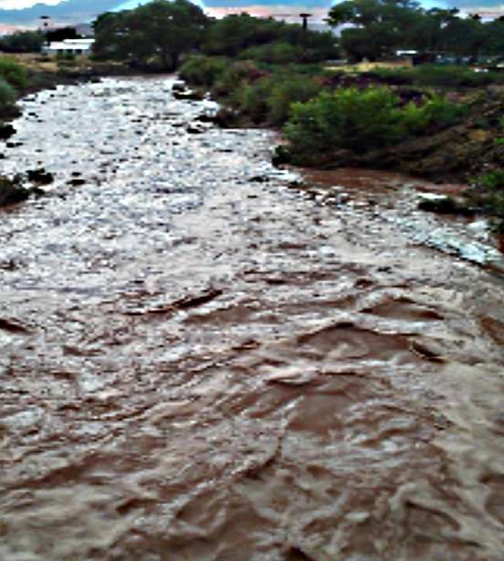
| As cities throughout southern Utah recovered from flooding over Friday night, others endured another round of thunderstorms that turned streets into rivers on Saturday. Cedar City Police Sgt. Jerry Womack said police responded to calls of debris in the roads, missing manhole covers and a few flooded homes. Womack said he saw water running through Center Street. The rain stopped about 8 p.m. The National Weather Service reported Saturday that the Cedar City airport recorded 2.25 inches of rain inches of rain. In the first 45 minutes, the total rainfall was already 2 inches. It was an all-time, one-day record for the city, breaking the 2.1 inches recorded in September 1967. Rocky Mountain Power reported that as much as 5,700 Cedar City homes and businesses were without power. By 8 p.m., that number went down to about 2,900. The weather service issued a flash flood watch through late Saturday night as thunderstorm conditions continued to prevail in south central and south west Utah. Forecasters also issued a flash flood warning for Cedar City and Central Iron County near Bryce Canyon National Park, meaning flooding was either imminent or had already happened in those areas. The weather service warned of torrential rains could overwhelm local drainages and damage homes in low-lying areas. The town of Washington also braced for more rain Saturday after their streets turned to rivers Friday night. According to Mayor Ken Neilson, about 10 to 15 houses in the city’s north end were flooded and damaged. Emergency workers worked through the night filling sandbags and delivering them to residents who wanted them.Neilson said in some areas, it looked like someone could go tubing through the streets if they wanted to. |
Heavy rains cause flooding, state of emergency in Catawba Co.

"Houses back in there that you can't even get to for the water, cars flooded, homes damaged, definitely,” said Tina Huggins, a Newton resident.
County officials said 50 roads and bridges were washed out or impassable. Many residents can't get out of their neighborhoods.
"I've never seen this in all the years I've lived here. I never expected it to ever be like this,” Huggins said.
Huggins has lived in newton for 30 years. She, like many other residents, drove around town to take photos of the damage.
Southside park was one of the worst-hit areas.
"I was shocked you know because you just don't expect water to cover up a park to cover up everything,” she said.
Everything from tree trunks to volleyball courts.
Read More Here
...
Heavy rain floods southern Utah towns (video)
Weather » Rainfall in Cedar City set a new one-day record.
By Kimball Bennion
and Jim Dalrymple II
| The Salt Lake Tribune
As
cities throughout southern Utah recovered from flooding over Friday
night, others endured another round of thunderstorms that turned streets
into rivers on Saturday.
Cedar City Police
Sgt. Jerry Womack said police responded to calls of debris in the roads,
missing manhole covers and a few flooded homes. Womack said he saw
water running through Center Street.
"It was running like a river," he said.
The rain stopped about 8 p.m.
The
National Weather Service reported Saturday that the Cedar City airport
recorded 2.25 inches of rain inches of rain. In the first 45 minutes,
the total rainfall was already 2 inches. It was an all-time, one-day
record for the city, breaking the 2.1 inches recorded in September 1967.
Related articles


No comments:
Post a Comment
Hello and thank you for visiting my blog. Please share your thoughts and leave a comment :)